Morondava
| Morondava | |
|---|---|
City | |
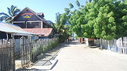 | |
 Morondava | |
Coordinates: 20°17′5″S 44°19′3″E / 20.28472°S 44.31750°E / -20.28472; 44.31750 | |
| Country | |
| Region | Menabe |
| Elevationcoastal | 8 m (26 ft) |
| Climate | BSh |
Morondava [murunˈdav̥] is a city located in Menabe Region, of which it is the capital, in Madagascar. It is located in the delta of the Morandava River at 20°17′5″S 44°19′3″E / 20.28472°S 44.31750°E / -20.28472; 44.31750Coordinates: 20°17′5″S 44°19′3″E / 20.28472°S 44.31750°E / -20.28472; 44.31750.
Contents
1 Climate
2 Transportation
3 Ecology
4 Education
5 See also
6 References
7 External links
Climate
| Climate data for Morondava | |||||||||||||
|---|---|---|---|---|---|---|---|---|---|---|---|---|---|
| Month | Jan | Feb | Mar | Apr | May | Jun | Jul | Aug | Sep | Oct | Nov | Dec | Year |
| Average high °C (°F) | 31.9 (89.4) | 31.8 (89.2) | 32.2 (90) | 31.8 (89.2) | 30.4 (86.7) | 29.0 (84.2) | 28.7 (83.7) | 29.1 (84.4) | 29.7 (85.5) | 30.7 (87.3) | 31.6 (88.9) | 31.9 (89.4) | 30.7 (87.3) |
| Daily mean °C (°F) | 27.4 (81.3) | 27.2 (81) | 27.1 (80.8) | 25.8 (78.4) | 23.2 (73.8) | 21.2 (70.2) | 21.0 (69.8) | 21.9 (71.4) | 23.5 (74.3) | 25.3 (77.5) | 26.6 (79.9) | 27.3 (81.1) | 24.8 (76.6) |
| Average low °C (°F) | 23.4 (74.1) | 23.2 (73.8) | 22.6 (72.7) | 20.5 (68.9) | 17.0 (62.6) | 14.5 (58.1) | 14.3 (57.7) | 15.3 (59.5) | 17.6 (63.7) | 20.1 (68.2) | 21.6 (70.9) | 22.9 (73.2) | 19.4 (66.9) |
| Average rainfall mm (inches) | 241.6 (9.512) | 200.0 (7.874) | 89.5 (3.524) | 14.8 (0.583) | 11.4 (0.449) | 2.4 (0.094) | 2.3 (0.091) | 2.2 (0.087) | 3.6 (0.142) | 11.9 (0.469) | 20.6 (0.811) | 163.3 (6.429) | 763.6 (30.063) |
| Average precipitation days (≥ 1.0 mm) | 11 | 10 | 6 | 1 | 1 | 1 | 1 | 1 | 1 | 1 | 2 | 8 | 44 |
| Mean monthly sunshine hours | 269.3 | 241.6 | 287.8 | 290.0 | 302.5 | 289.4 | 297.6 | 310.0 | 298.1 | 322.1 | 313.2 | 283.4 | 3,505 |
| Source: NOAA[1] | |||||||||||||
Transportation
Air Madagascar has regular scheduled flights to Morondava Airport. The main road to town has been renovated recently. With the new road established, a trip from Antananarivo to Morondava by taxi-brousse takes approximately 12 hours. Pirogues are consequently a popular mode of transport used to ferry people and goods along the coast, especially to Morombe.
Ecology
The city is famous amongst other things for the spectacular Avenue of Baobabs nearby at 20°15′04″S 44°25′06″E / 20.251000°S 44.418403°E / -20.251000; 44.418403 (Avenue of Baobabs). These giant baobab trees are an 800-year-old legacy of the dense tropical forests that once throve here. Over the years, as the country's population grew, the forests were steadily cut down, leaving only the baobab trees, which the locals preserved for religious reasons. Today, deforestation still continues as large areas of this region, including some of few remaining baobabs, are cleared to make way for sugar cane plantations.
The Tsingy de Bemaraha Strict Nature Reserve, a UNESCO World Heritage Site, is located 150 km north of Morondava. The road from Morondava is poor, but Tsingy de Bemaraha is reachable by 4x4 in approximately 10 hours.
In the South there is the Andranomena Reserve.
Kirindy Forest at 20°04′12″S 44°36′07″E / 20.070000°S 44.601944°E / -20.070000; 44.601944 (Kirindy Forest) is a nature reserve about 60 km from Morondava where many of the local species of lemurs as well as other plants and animals can be spotted during a day or night trip.
Education
French international schools:
- École de l'Alliance[2]
See also
- Tsingy de Bemaraha Strict Nature Reserve
- Madagascar dry deciduous forests
References
^ "Morondava Climate Normals 1961–1990". National Oceanic and Atmospheric Administration. Retrieved October 19, 2015..mw-parser-output cite.citation{font-style:inherit}.mw-parser-output q{quotes:"""""""'""'"}.mw-parser-output code.cs1-code{color:inherit;background:inherit;border:inherit;padding:inherit}.mw-parser-output .cs1-lock-free a{background:url("//upload.wikimedia.org/wikipedia/commons/thumb/6/65/Lock-green.svg/9px-Lock-green.svg.png")no-repeat;background-position:right .1em center}.mw-parser-output .cs1-lock-limited a,.mw-parser-output .cs1-lock-registration a{background:url("//upload.wikimedia.org/wikipedia/commons/thumb/d/d6/Lock-gray-alt-2.svg/9px-Lock-gray-alt-2.svg.png")no-repeat;background-position:right .1em center}.mw-parser-output .cs1-lock-subscription a{background:url("//upload.wikimedia.org/wikipedia/commons/thumb/a/aa/Lock-red-alt-2.svg/9px-Lock-red-alt-2.svg.png")no-repeat;background-position:right .1em center}.mw-parser-output .cs1-subscription,.mw-parser-output .cs1-registration{color:#555}.mw-parser-output .cs1-subscription span,.mw-parser-output .cs1-registration span{border-bottom:1px dotted;cursor:help}.mw-parser-output .cs1-hidden-error{display:none;font-size:100%}.mw-parser-output .cs1-visible-error{font-size:100%}.mw-parser-output .cs1-subscription,.mw-parser-output .cs1-registration,.mw-parser-output .cs1-format{font-size:95%}.mw-parser-output .cs1-kern-left,.mw-parser-output .cs1-kern-wl-left{padding-left:0.2em}.mw-parser-output .cs1-kern-right,.mw-parser-output .cs1-kern-wl-right{padding-right:0.2em}
^ "École de l'Alliance." AEFE. Retrieved on May 7, 2015.
External links
| Wikimedia Commons has media related to Morondava. |
 Morondava travel guide from Wikivoyage
- What are the historical causes of deforestation in Madagascar and what is the situation today?
| Belo sur Tsiribihina |
|  |
|---|---|---|
| Mahabo |
| |
| Manja |
| |
| Miandrivazo |
| |
| Morondava |
| |
Authority control |
|
|---|


