Wundschuh
| Wundschuh | ||
|---|---|---|
| ||
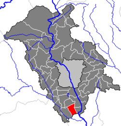
 Wundschuh Location within Austria Location within Graz-Umgebung district
| ||
Coordinates: 46°55′35″N 15°27′4″E / 46.92639°N 15.45111°E / 46.92639; 15.45111Coordinates: 46°55′35″N 15°27′4″E / 46.92639°N 15.45111°E / 46.92639; 15.45111 | ||
| Country | Austria | |
| State | Styria | |
| District | Graz-Umgebung | |
| Government | ||
| • Mayor | Karl Brodschneider (ÖVP) | |
| Area | ||
| • Total | 12.75 km2 (4.92 sq mi) | |
| Elevation | 322 m (1,056 ft) | |
| Population (1 January 2016)[1] | ||
| • Total | 1,544 | |
| • Density | 120/km2 (310/sq mi) | |
| Time zone | UTC+1 (CET) | |
| • Summer (DST) | UTC+2 (CEST) | |
| Postal code | 8142 | |
| Area code | 03135 | |
| Vehicle registration | GU | |
| Website | www.wundschuh.at | |

Wundschuh is a municipality in the district of Graz-Umgebung in the Austrian state of Styria.
Contents
1 Geography
1.1 Subdivisions
1.2 Neighboring municipalities
2 References
Geography
Wundschuh lies in the Graz basin in the Kaiser forest about 12 km south of Graz.
Subdivisions
Katastralgemeinden are Kasten and Wundschuh. Other communities are Forst, pop. 122, Gradenfeld, pop. 176, Kasten, pop. 319, Ponigl, pop. 104, and Wundschuh, pop, 676.
Neighboring municipalities
Places adjacent to Wundschuh | ||||||||||
|---|---|---|---|---|---|---|---|---|---|---|
| ||||||||||

References
^ Statistik Austria - Bevölkerung zu Jahresbeginn 2002-2016 nach Gemeinden (Gebietsstand 1.1.2016) for Wundschuh.
This Styria location article is a stub. You can help Wikipedia by expanding it. |


