National Highway 19 (India)
National Highway 19 | ||||
|---|---|---|---|---|
Map of National Highway 19 in red | ||||
 Durgapur Expressway - NH 19 | ||||
| Route information | ||||
| Part of | ||||
| Length | 1,435 km (892 mi) | |||
| Major junctions | ||||
| West end | Delhi | |||
| East end | Dankuni,Kolkata | |||
| Location | ||||
| States | Uttar Pradesh, Bihar, Jharkhand, West Bengal | |||
| Primary destinations | Kanpur, Fatehpur,Prayagraj, Varanasi, Mughalsarai, Mohania, Sasaram, Aurangabad, Dobhi, Barhi, Bagodar, Gobindpur, Asansol, Durgapur | |||
| Highway system | ||||
| ||||
National Highway 19 (NH 19) is a National Highway in India.[1] Often referred to as Delhi–Kolkata Road, it is one of the busiest National Highways in India.
It was earlier known as NH 2 before renumbering of all national highways by National Highway Authority of India in 2010.
Contents
1 Length
2 National Highways Development Project
3 Route
4 Toll plazas
5 Major cities on/off NH 19
6 See also
7 References
8 External links
Length
The highway has a length of 1,435 km (892 mi) and runs through the states of Delhi, Uttar Pradesh, Bihar, Jharkhand, and West Bengal. It constitutes a major portion of the historical Grand Trunk Road along with NH 1 and NH 91 in India.
The lengths of the highway in each state are:
Delhi: 12 km (7.5 mi)
Haryana: 74 km (46 mi)
Uttar Pradesh: 752 km (467 mi)
Bihar: 202 km (126 mi)
Jharkhand: 190 km (120 mi)
West Bengal: 235 km (146 mi)
National Highways Development Project

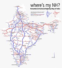
Schematic map of National Highways in India
- Almost all of the 1,435 km (892 mi) stretch of NH 19 has been selected as a part of the Golden Quadrilateral by the National Highways Development Project.[2]
- Approximately 253 km (157 mi) stretch of NH 19 between Delhi and Agra has been selected as a part of the North-South Corridor by the National Highways Development Project.[2]
- Approximately 35 km (22 mi) stretch of NH 19 between Barah and Kanpur has been selected as a part of the East-West Corridor by the National Highways Development Project.[2]
- It is also part of AH1 of Asian Highway Network, that traverses from Japan to Turkey.

NH-19, Khaga, Fatehpur district, Uttar Pradesh
Route
National Highway 19 connects Agra to Kolkata and transits four states of India, namely Uttar Pradesh, Bihar, Jharkhand and west Bengal.[3]
NH-44 near Agra connecting Kanpur, Allahabad, Varanashi in the State of Uttar Pradesh, Mohania, Aurangabad, Dobhi in the State of Bihar, Barhi, Bagodar, Gobindpur in the State of Jharkhand, Asansol, Palsit and terminating at its junction with NH-16 near Kolkata in the State of West Bengal.
Toll plazas
From Delhi to Kolkata the toll plazas are as follows: Uttar Pradesh Tundla, Gurau Semra Atikabad, Anantram, Barajod, Badauri, Katoghan, Prayagraj Bypass (Khokhraj), Lalanagar, Daffi Bihar Mohania, Sasaram, Saukala Jharkhand Rasoiya Dhamna, Ghangri, Beliyad West Bengal Durgapur, Palsit and Dankuni.[4]
Major cities on/off NH 19
- Uttar Pradesh
- Agra
- Firozabad
- Etawah
- Babarpur Ajitmal
- Auraiya
- Akbarpur
- Kanpur
- Fatehpur
- Prayagraj
- Varanasi
- Mughalsarai
- Bihar
- Mohania
- Sasaram
- Dehri on sone
- Aurangabad
- Jharkhand
- Barhi
- BARKATHA
- Isri
- Gobindpur
- Dhanbad
- West Bengal
- Asansol
- Durgapur
- Burdwan
- Dankuni
See also
- List of National Highways in India
- List of National Highways in India by state
Howrah-Gaya-Delhi line railway track connecting Delhi and Kolkata- National Highway 2 (India, old numbering)
- Grand Trunk Road
References
^ "Rationalisation of Numbering Systems of National Highways" (PDF). New Delhi: Department of Road Transport and Highways. Retrieved 3 April 2012..mw-parser-output cite.citation{font-style:inherit}.mw-parser-output .citation q{quotes:"""""""'""'"}.mw-parser-output .citation .cs1-lock-free a{background:url("//upload.wikimedia.org/wikipedia/commons/thumb/6/65/Lock-green.svg/9px-Lock-green.svg.png")no-repeat;background-position:right .1em center}.mw-parser-output .citation .cs1-lock-limited a,.mw-parser-output .citation .cs1-lock-registration a{background:url("//upload.wikimedia.org/wikipedia/commons/thumb/d/d6/Lock-gray-alt-2.svg/9px-Lock-gray-alt-2.svg.png")no-repeat;background-position:right .1em center}.mw-parser-output .citation .cs1-lock-subscription a{background:url("//upload.wikimedia.org/wikipedia/commons/thumb/a/aa/Lock-red-alt-2.svg/9px-Lock-red-alt-2.svg.png")no-repeat;background-position:right .1em center}.mw-parser-output .cs1-subscription,.mw-parser-output .cs1-registration{color:#555}.mw-parser-output .cs1-subscription span,.mw-parser-output .cs1-registration span{border-bottom:1px dotted;cursor:help}.mw-parser-output .cs1-ws-icon a{background:url("//upload.wikimedia.org/wikipedia/commons/thumb/4/4c/Wikisource-logo.svg/12px-Wikisource-logo.svg.png")no-repeat;background-position:right .1em center}.mw-parser-output code.cs1-code{color:inherit;background:inherit;border:inherit;padding:inherit}.mw-parser-output .cs1-hidden-error{display:none;font-size:100%}.mw-parser-output .cs1-visible-error{font-size:100%}.mw-parser-output .cs1-maint{display:none;color:#33aa33;margin-left:0.3em}.mw-parser-output .cs1-subscription,.mw-parser-output .cs1-registration,.mw-parser-output .cs1-format{font-size:95%}.mw-parser-output .cs1-kern-left,.mw-parser-output .cs1-kern-wl-left{padding-left:0.2em}.mw-parser-output .cs1-kern-right,.mw-parser-output .cs1-kern-wl-right{padding-right:0.2em}
^ abc [1] National Highways-Source-National Highways Authority of India (NHAI)
^ "Route substitution for national highways 9, 19, 44 and 48" (PDF). The Gazette of India. Retrieved 6 Dec 2018.
^ "Toll Calculator". Toll between. Retrieved 25 January 2017.
External links
Route mapRoute map
| Wikimedia Commons has media related to National Highway 19. |
This Indian road or road transport-related article is a stub. You can help Wikipedia by expanding it. |


