Scarisbrick
| Scarisbrick | |
|---|---|
 St Elizabeth's Church | |
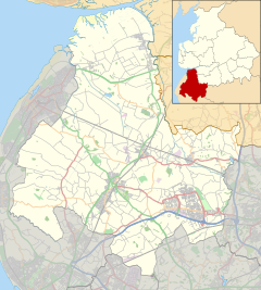 Scarisbrick Location in West Lancashire Show map of the Borough of West Lancashire  Scarisbrick Scarisbrick shown within Lancashire Show map of Lancashire | |
| Population | 3,554 (2011 Census) |
| OS grid reference | SD382130 |
| Civil parish |
|
| District |
|
| Shire county |
|
| Region |
|
| Country | England |
| Sovereign state | United Kingdom |
| Post town | ORMSKIRK |
| Postcode district | L40 |
| Post town | SOUTHPORT |
| Postcode district | PR8, PR9 |
| Dialling code | 01704 |
| Police | Lancashire |
| Fire | Lancashire |
| Ambulance | North West |
| EU Parliament | North West England |
| UK Parliament |
|
Scarisbrick (/ˈskeɪzbrɪk, ˈskɛərz-/) is a village and civil parish in West Lancashire, England. The A570, the main road between Ormskirk and Southport, runs through Scarisbrick, and much of the village lies along it. As a result, it does not have a traditional village centre, though the junction with the A5147 is close to the geographic centre.
Contents
1 Toponymy
2 History
3 Demography
4 Transport
5 Notable people
6 See also
7 References
7.1 Bibliography
8 External links
Toponymy
Scarisbrick literally means "Skar's slope" and comes from the Old Norse Skar (a personal name) + -es (possessive) + brekka ("slope"). It is thought that the personal name is Danish, though the second element suggests Norwegian settlement. The "slope" may refer to a slight incline between two streams near the site of Scarisbrick Hall. The name was recorded as Scharisbrec c.1200, Skaresbrek in 1238, and finally Scarisbrick c.1240.[1]
History

World War II pillbox at Heatons Bridge.
In its early history, travellers tended to avoid Scarisbrick parish. Martin Mere, a large lake with associated marshlands and peat bogs, made the immediate area quite difficult to cross. Much of the flat land between Southport and Liverpool is polder reclaimed from marshes and the lake. The modern-day hamlets of Barrison Green, Bescar, Carr Cross, Drummersdale, Hurlston, Pinfold, and Snape Green were formed from the early farms and settlements that did arise in the area.
Scarisbrick still contains many structures and artefacts from its past. The Old School House, constructed in 1809, has served several roles in its history and now contains two residences. A pillbox constructed during World War II can be found near a bridge over the Leeds and Liverpool Canal. It was from Pinfold, where the canal is closest to Southport, that William Sutton picked up waterway passengers for transport to his "Original Hotel", known better as "Duke's Folly" - the foundation of Southport. The canal now is used for recreational purposes. The only Catholic church there, St Elizabeth's, was founded by the Marquis of Casteja and was named after his wife. There are many other churches there as well.
"Wheelwrights House", a former workshop located on Southport Road, is another of the many listed buildings in Scarisbrick.[2]
Places adjacent to Scarisbrick | ||||||||||
|---|---|---|---|---|---|---|---|---|---|---|
| ||||||||||
Demography
According to the United Kingdom Census 2011, Scarisbrick parish had a population of 3,554 people living in 1,505 households, with an almost even distribution between males and females.[3] The parish covers an area of 3,207 hectares (12.38 sq mi; 32.07 km2), giving a population density of 1.1 inhabitants per hectare (280/sq mi; 110/km2).[4] The increase in population from 3,204 in 2001 represents a growth rate of 7001109000000000000♠10.9% over ten years.[5]
A majority of 7001972000000000000♠97.2% of residents were born in the United Kingdom,[6] and 7001968000000000000♠96.8% identified as being of "White British" ethnicity.[7] Religion was recorded as 7001785000000000000♠78.5% Christian, with 7001145000000000000♠14.5% of residents being of no religion, and 7000610000000000000♠6.1% declining to state; only 6999900000000000000♠0.9% belonged to an alternative religion.[8] Of the 2,695 residents aged between 16 and 74, 7001677000000000000♠67.7% were regarded as economically active, and of those 7000470000000000000♠4.7% were unemployed.[9]
Transport

375 bus service from Southport to Wigan, operated by Arriva North West.
Scarisbrick is situated on the A570 road, which runs northwest through the parish between Ormskirk and Southport for a distance of approximately 4.7 miles (7.6 km). The A5147 road, which runs north from Maghull through Halsall, terminates at its junction with the A570 at Scarisbrick. There are also two B roads, the B5242 which leads towards Burscough, and the B5243 which provides an alternative route into Southport. The nearest motorway links are junction 3 of the M58, about 4.4 miles (7.1 km) to the southeast at Bickerstaffe, and junction 27 of the M6, which is about 7.9 miles (12.7 km) due east at Wrightington.[10]
Arriva North West operate several bus services in Scarisbrick. The 385 and 375 are hourly services from Southport to Wigan which both follow similar routes; the 385 crosses Scarisbrick directly along the A570, while the 375 takes a diversion along the B5242 through the more rural parts of the parish, before rejoining the A570 at Ormskirk.[11] The half-hourly 300 service from Southport to Liverpool also passes through Scarisbrick.[12]
Bescar Lane railway station, which opened in 1855,[13] is managed by Northern on the Manchester to Southport Line. As of May 2015, trains generally operate eight times a day Monday–Saturday in each direction, travelling westbound to Southport (12–15 minutes) and eastbound to Manchester stations via Wigan Wallgate (65–70 minutes). There are no train services at Bescar Lane on Sundays.[14] During the 2013–14 financial year, the station was used by an estimated 3,146 passengers.[15]
Heathey Lane Halt, a station on the Barton branch of the Lancashire and Yorkshire Railway, was situated on the boundary between Scarisbrick and Halsall, just to the north of the B5243 road bridge. The station was in operation between 1907 and 1938, and the line itself closed in 1952.[13]
Notable people
@media all and (max-width:720px){.mw-parser-output .tmulti>.thumbinner{width:100%!important;max-width:none!important}.mw-parser-output .tmulti .tsingle{float:none!important;max-width:none!important;width:100%!important;text-align:center}}

Derek Acorah (real name Derek Johnson, born Bootle 1950), spirit medium and television personality known for his work on the series Most Haunted, lives in Scarisbrick.[16]
Michael Hastings, Baron Hastings of Scarisbrick, CBE (born 1958), life peer educated at Scarisbrick Hall School.[17]
John Lennon (1940–1980), singer-songwriter and co-founder of the Beatles, employed as a labourer at Mill Brow waterworks in 1959.[18]
Johnny Mitchell (born 1971), former professional American football player, coaches American sports at Scarisbrick Hall School.[19]
Samuel Nevill (1837–1921), first Bishop of Dunedin in New Zealand and former curate of Scarisbrick.[20]
- St John Plessington (c.1637–1679), priest educated at Scarisbrick Hall, canonised as one of the Forty Martyrs of England and Wales in 1970.[21]
Will Sergeant (born 1958), musician and guitarist with Echo & the Bunnymen, lives in Scarisbrick.[22]
James Valiant (1884–1917), cricketer formerly of the Morris Dancers public house, died of wounds during World War I.[23]
See also
- Scarisbrick Hall
- Scarisbrick Hall School
- St Mark's Church, Scarisbrick
- Listed buildings in Scarisbrick
References
^ Mills, David (1976). The Place Names of Lancashire. B. T. Batsford. ISBN 0-7134-3248-9..mw-parser-output cite.citation{font-style:inherit}.mw-parser-output q{quotes:"""""""'""'"}.mw-parser-output code.cs1-code{color:inherit;background:inherit;border:inherit;padding:inherit}.mw-parser-output .cs1-lock-free a{background:url("//upload.wikimedia.org/wikipedia/commons/thumb/6/65/Lock-green.svg/9px-Lock-green.svg.png")no-repeat;background-position:right .1em center}.mw-parser-output .cs1-lock-limited a,.mw-parser-output .cs1-lock-registration a{background:url("//upload.wikimedia.org/wikipedia/commons/thumb/d/d6/Lock-gray-alt-2.svg/9px-Lock-gray-alt-2.svg.png")no-repeat;background-position:right .1em center}.mw-parser-output .cs1-lock-subscription a{background:url("//upload.wikimedia.org/wikipedia/commons/thumb/a/aa/Lock-red-alt-2.svg/9px-Lock-red-alt-2.svg.png")no-repeat;background-position:right .1em center}.mw-parser-output .cs1-subscription,.mw-parser-output .cs1-registration{color:#555}.mw-parser-output .cs1-subscription span,.mw-parser-output .cs1-registration span{border-bottom:1px dotted;cursor:help}.mw-parser-output .cs1-hidden-error{display:none;font-size:100%}.mw-parser-output .cs1-visible-error{font-size:100%}.mw-parser-output .cs1-subscription,.mw-parser-output .cs1-registration,.mw-parser-output .cs1-format{font-size:95%}.mw-parser-output .cs1-kern-left,.mw-parser-output .cs1-kern-wl-left{padding-left:0.2em}.mw-parser-output .cs1-kern-right,.mw-parser-output .cs1-kern-wl-right{padding-right:0.2em}
^ https://www.panoramio.com/photo/19952249
^ "Key Figures for 2011 Census: Key Statistics". Office for National Statistics. Retrieved 13 April 2015.
^ "Usual Resident Population, 2011 (KS101EW)". Office for National Statistics. Retrieved 13 April 2015.
^ "Key Figures for 2001 Census: Key Statistics". Office for National Statistics. Retrieved 13 April 2015.
^ "Country of Birth (detailed), 2011 (QS203EW)". Office for National Statistics. Retrieved 13 April 2015.
^ "Ethnic Group, 2011 (QS201EW)". Office for National Statistics. Retrieved 13 April 2015.
^ "Religion, 2011 (QS208EW)". Office for National Statistics. Retrieved 13 April 2015.
^ "Economic Activity, 2011 (QS601EW)". Office for National Statistics. Retrieved 13 April 2015.
^ "Election Maps". Ordnance Survey. Retrieved 11 April 2015.
^ "Southport to Wigan via Ormskirk, Skelmersdale and Wigan". Arriva North West. Retrieved 11 April 2015.
^ "Southport to Liverpool via Maghull and Bootle". Arriva North West. Retrieved 11 April 2015.
^ ab Gell, Rob (1986). An Illustrated Survey of Railway Stations Between Southport & Liverpool 1848–1986. Heyday Publishing Company. ISBN 0-947562-04-4.
^ "Timetables - Bescar Lane". Northern Rail. Retrieved 11 April 2015.
^ "Estimates of station usage". Office of Rail and Road. Retrieved 11 April 2015.
^ "Ormskirk is home to the world's most haunted house - says Derek Acorah". Ormskirk & Skelmersdale Advertiser. 19 March 2009. Retrieved 11 April 2015.
^ "Michael John Hastings, Hastings of Scarisbrick". Debrett's. Retrieved 19 April 2015.
^ Bowman, Jamie (23 January 2014). "John Lennon's lost summer building Scarisbrick waterworks revealed in new book". Ormskirk & Skelmersdale Advertiser. Retrieved 15 April 2015.
^ "NFL legend takes up role coaching US sports at Scarisbrick Hall School". Southport Visiter. 17 November 2011. Retrieved 15 April 2015.
^ Booth, Ken (4 December 2013) [First published in the Dictionary of New Zealand Biography Volume 2, 1993]. "Story: Nevill, Samuel Tarratt". Te Ara - the Encyclopedia of New Zealand. Retrieved 11 April 2015.
^ "The martyr whom King Charles II did nothing to help". Catholic Herald. 16 July 2010. Retrieved 13 April 2015.
^ "Win tickets to see Echo and the Bunnymen at Liverpool Olympia". Southport Visiter. 28 May 2010. Retrieved 11 April 2015.
^ "Flannels—Now Khaki". The Ormskirk Advertiser. 18 November 1915. p. 5.
Bibliography
Duggan, Mona (1996). A History of Scarisbrick. Carnegie Publishing. ISBN 1-85936-040-8.
Edwards, Margaret (1987). Scarisbrick in Times Past. Countryside Publications. ISBN 0-86157-267-X.
External links
| Wikimedia Commons has media related to Scarisbrick. |
Scarisbrick Today – Community website
St Marks Church – Parish church website


