Urmia County
Urmia County شهرستان ارومیه | |
|---|---|
| County | |
 Counties of West Azerbaijan Province | |
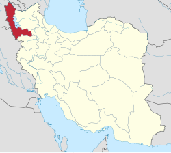 Location of West Azerbaijan Province in Iran | |
| Coordinates: 37°33′N 45°00′E / 37.550°N 45.000°E / 37.550; 45.000Coordinates: 37°33′N 45°00′E / 37.550°N 45.000°E / 37.550; 45.000 | |
| Country | |
| Province | West Azerbaijan |
| Capital | Urmia |
Bakhsh (Districts) | Central District, Anzal District, Silvaneh District, Sumay-ye Beradust District, Nazlu District |
| Population (2016) | |
| • Total | 1,040,565 |
| Time zone | UTC+3:30 (IRST) |
| • Summer (DST) | UTC+4:30 (IRDT) |
| Urmia County can be found at GEOnet Names Server, at this link, by opening the Advanced Search box, entering "9205903" in the "Unique Feature Id" form, and clicking on "Search Database". | |
Urmia County (Persian: شهرستان ارومیه) is a county in West Azerbaijan Province in Iran. The capital of the county is Urmia city. At the 2016 census, the county's population was 1,040,565, in 304,306 households.[1] The county has five cities: Urmia, Qushchi, Silvaneh, Serow, and Nushin. 90% of the population are Azarbaijanis and 10% are Kurdish, Armenian, and Assyrian.
Administrative divisions
| Urmia County map |
|---|
 Urmia Anzal Silvaneh Sumay-ye Beradust Nazlu Salmas Oshnaviyeh Naqadeh Iraq Turkey Lake Urmia |
Urmia County is divided into five districts:
Central: Bakeshluchay Rural District, Baranduz Rural District, Baranduzchay-ye Jonubi Rural District, Baranduzchay-ye Shomali Rural District, Bash Qaleh Rural District, Dul Rural District, Nazluy-ye Jonubi Rural District, Rowzeh Chay Rural District, and Torkaman Rural District, with Urmia as the administrative seat.
Anzal: Anzal-e Jonubi Rural District and Anzal-e Shomali Rural District, with Qushchi as the administrative seat.
Nazlu: Nazluchay Rural District, Nazlu-e Shomali Rural District and Tala Tappeh Rural District, with Nushin as the administrative seat.
Silvaneh: Dasht Rural District, Margavar Rural District, and Targavar Rural District, with Silvane as the administrative seat.
Sumay-ye Beradust: Beradust Rural District, Sumay-ye Jonubi Rural District, and Sumay-ye Shomali Rural District, with Serow as the administrative seat.
References
^ "Census of the Islamic Republic of Iran, 1395 (2016)" (Excel). Islamic Republic of Iran..mw-parser-output cite.citation{font-style:inherit}.mw-parser-output q{quotes:"""""""'""'"}.mw-parser-output code.cs1-code{color:inherit;background:inherit;border:inherit;padding:inherit}.mw-parser-output .cs1-lock-free a{background:url("//upload.wikimedia.org/wikipedia/commons/thumb/6/65/Lock-green.svg/9px-Lock-green.svg.png")no-repeat;background-position:right .1em center}.mw-parser-output .cs1-lock-limited a,.mw-parser-output .cs1-lock-registration a{background:url("//upload.wikimedia.org/wikipedia/commons/thumb/d/d6/Lock-gray-alt-2.svg/9px-Lock-gray-alt-2.svg.png")no-repeat;background-position:right .1em center}.mw-parser-output .cs1-lock-subscription a{background:url("//upload.wikimedia.org/wikipedia/commons/thumb/a/aa/Lock-red-alt-2.svg/9px-Lock-red-alt-2.svg.png")no-repeat;background-position:right .1em center}.mw-parser-output .cs1-subscription,.mw-parser-output .cs1-registration{color:#555}.mw-parser-output .cs1-subscription span,.mw-parser-output .cs1-registration span{border-bottom:1px dotted;cursor:help}.mw-parser-output .cs1-hidden-error{display:none;font-size:100%}.mw-parser-output .cs1-visible-error{font-size:100%}.mw-parser-output .cs1-subscription,.mw-parser-output .cs1-registration,.mw-parser-output .cs1-format{font-size:95%}.mw-parser-output .cs1-kern-left,.mw-parser-output .cs1-kern-wl-left{padding-left:0.2em}.mw-parser-output .cs1-kern-right,.mw-parser-output .cs1-kern-wl-right{padding-right:0.2em}
- اطلس گیتاشناسی استانهای ایران [Atlas Gitashenasi Ostanhai Iran] (Gitashenasi Province Atlas of Iran)
List of cities, towns and villages in West Azerbaijan Province | ||
| Capital |
|  |
Counties and cities |
| |
| Tourism |
| |
| Places | List of cities, towns and villages in West Azerbaijan Province | |
| Capital |
| ||||||||||||||||||||||||||||||||||||||||||||||||||||||||||||||||||||||
|---|---|---|---|---|---|---|---|---|---|---|---|---|---|---|---|---|---|---|---|---|---|---|---|---|---|---|---|---|---|---|---|---|---|---|---|---|---|---|---|---|---|---|---|---|---|---|---|---|---|---|---|---|---|---|---|---|---|---|---|---|---|---|---|---|---|---|---|---|---|---|---|
| Districts |
| ||||||||||||||||||||||||||||||||||||||||||||||||||||||||||||||||||||||
This Urmia County location article is a stub. You can help Wikipedia by expanding it. |


