Samko District
Sam Ko สามโก้ | |
|---|---|
Amphoe | |
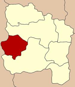 Amphoe location in Ang Thong Province | |
| Coordinates: 14°36′20″N 100°14′41″E / 14.60556°N 100.24472°E / 14.60556; 100.24472Coordinates: 14°36′20″N 100°14′41″E / 14.60556°N 100.24472°E / 14.60556; 100.24472 | |
| Country | Thailand |
| Province | Ang Thong |
| Tambon | 5 |
| Muban | 37 |
| Area | |
| • Total | 95.4 km2 (36.8 sq mi) |
| Population (2012) | |
| • Total | 19,314 |
| • Density | 200/km2 (520/sq mi) |
| Time zone | UTC+7 (ICT) |
| Postal code | 14160 |
| Geocode | 1507 |
Sam Ko (Thai: สามโก้) is the district (amphoe) in the western part of Ang Thong Province, central Thailand.
Contents
1 History
2 Geography
3 Administration
4 References
History
The district was separated from Wiset Chai Chan District to become a minor district (king amphoe) in 1962.[1] It was upgraded to full district in 1965.[2]
Geography
Neighboring districts are (from the north clockwise) Pho Thong and Wiset Chai Chan of Ang Thong Province and Si Prachan of Suphanburi Province.
Administration
The district is divided into five sub-districts (tambon) and 37 administrative villages (muban). The sub-district municipality (thesaban tambon) Samko covers the tambon Samko, Ratsadon Phatthana, and Mongkhon Tham Nimit. Op Thom and Pho Muang Phan have a tambon administrative organization as their local government.
| No. | Name | Thai | Villages | Pop.[3] |
|---|---|---|---|---|
| 1. | Samko | สามโก้ | 10 | 5,078 |
| 2. | Ratsadon Phatthana | ราษฎรพัฒนา | 06 | 2,599 |
| 3. | Op Thom | อบทม | 06 | 4,056 |
| 4. | Pho Muang Phan | โพธิ์ม่วงพันธ์ | 07 | 4,417 |
| 5. | Mongkhon Tham Nimit | มงคลธรรมนิมิต | 08 | 3,164 |
References
^ ประกาศกระทรวงมหาดไทย เรื่อง แบ่งท้องที่ตั้งเป็นกิ่งอำเภอ(PDF). Royal Gazette (in Thai). 79 (90 ง): 2097–2098. 1962-10-02..mw-parser-output cite.citation{font-style:inherit}.mw-parser-output .citation q{quotes:"""""""'""'"}.mw-parser-output .citation .cs1-lock-free a{background:url("//upload.wikimedia.org/wikipedia/commons/thumb/6/65/Lock-green.svg/9px-Lock-green.svg.png")no-repeat;background-position:right .1em center}.mw-parser-output .citation .cs1-lock-limited a,.mw-parser-output .citation .cs1-lock-registration a{background:url("//upload.wikimedia.org/wikipedia/commons/thumb/d/d6/Lock-gray-alt-2.svg/9px-Lock-gray-alt-2.svg.png")no-repeat;background-position:right .1em center}.mw-parser-output .citation .cs1-lock-subscription a{background:url("//upload.wikimedia.org/wikipedia/commons/thumb/a/aa/Lock-red-alt-2.svg/9px-Lock-red-alt-2.svg.png")no-repeat;background-position:right .1em center}.mw-parser-output .cs1-subscription,.mw-parser-output .cs1-registration{color:#555}.mw-parser-output .cs1-subscription span,.mw-parser-output .cs1-registration span{border-bottom:1px dotted;cursor:help}.mw-parser-output .cs1-ws-icon a{background:url("//upload.wikimedia.org/wikipedia/commons/thumb/4/4c/Wikisource-logo.svg/12px-Wikisource-logo.svg.png")no-repeat;background-position:right .1em center}.mw-parser-output code.cs1-code{color:inherit;background:inherit;border:inherit;padding:inherit}.mw-parser-output .cs1-hidden-error{display:none;font-size:100%}.mw-parser-output .cs1-visible-error{font-size:100%}.mw-parser-output .cs1-maint{display:none;color:#33aa33;margin-left:0.3em}.mw-parser-output .cs1-subscription,.mw-parser-output .cs1-registration,.mw-parser-output .cs1-format{font-size:95%}.mw-parser-output .cs1-kern-left,.mw-parser-output .cs1-kern-wl-left{padding-left:0.2em}.mw-parser-output .cs1-kern-right,.mw-parser-output .cs1-kern-wl-right{padding-right:0.2em}
^ พระราชกฤษฎีกาตั้งอำเภอศรีสวัสดิ์ อำเภอสังขละบุรี อำเภอท่าคันโท อำเภอดอกคำใต้ อำเภอแม่ใจ อำเภอจุน อำเภอขามทะเลสอ อำเภอไพศาลี อำเภอท่าวังผา อำเภอบ้านกรวด อำเภอเด่นชัย อำเภอปทุมรัตน์ อำเภอกะเปอร์ อำเภออากาศอำนวย อำเภอดอนเจดีย์ อำเภอจอมพระ และอำเภอสามโก้ พ.ศ. ๒๕๐๘(PDF). Royal Gazette (in Thai). 82 (59 ก): 565. 1965-07-27.
^ "Population statistics 2012". Department of Provincial Administration.
This Ang Thong Province location article is a stub. You can help Wikipedia by expanding it. |


