Ferguson Township, Centre County, Pennsylvania
Ferguson Township, Centre County, Pennsylvania | |
|---|---|
Home Rule Municipality | |
 St. Alban's Anglican Church in Pine Grove Mills | |
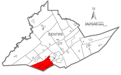 Map of Centre County, Pennsylvania highlighting Ferguson Township | |
 Map of Centre County, Pennsylvania | |
| Country | United States |
| State | Pennsylvania |
| County | Centre |
| Settled | 1791 |
| Incorporated | 1801 |
| Government | |
| • Type | Board of Supervisors |
| • Chairman (Ward 2) | Peter Buckland |
| • Vice-chair (At Large) | Steve Miller |
| • Supervisor (At large) | Tony (Tom) Ricciardi |
| • Supervisor (Ward 1) | Laura Dininni |
| • Supervisor (Ward 3) | Sara Spock Carlson |
| Area [1] | |
| • Total | 47.70 sq mi (123.55 km2) |
| • Land | 47.70 sq mi (123.54 km2) |
| • Water | 0.01 sq mi (0.01 km2) |
| Population (2010) | |
| • Total | 17,690 |
| • Estimate (2016)[2] | 19,350 |
| • Density | 405.69/sq mi (156.64/km2) |
| Time zone | UTC-5 (EST) |
| • Summer (DST) | UTC-4 (EDT) |
| Zip codes | 16801, 16803, 16868 (Pine Grove Mills) |
| Area code(s) | 814 |
| FIPS code | 42-027-25624 |
| Website | www.twp.ferguson.pa.us |
Ferguson Township is a home rule municipality, formerly a township, in Centre County, Pennsylvania, United States. It is part of the State College, Pennsylvania Metropolitan Statistical Area. The population was 17,690 at the 2010 census, which is a 25.8% increase from the 2000 census[1]. Most of the agricultural research for Pennsylvania State University (Penn State), located in nearby State College, Pennsylvania, is at the Russell E. Larson Research Center located in the western part of Ferguson Township.
Ferguson Township is served by the Ferguson Township Police Department and the Alpha Fire Company for police and fire protection.
Contents
1 History
2 Geography
3 Demographics
4 Gas development
5 References
6 External links
History
The Bucher Ayres Farm was added to the National Register of Historic Places in 1980.[3]
The township adopted a home rule charter in May 1974, effective January 5, 1976, retaining "Township of Ferguson" as its official name.[4] Despite the "Township" designation, Ferguson is no longer governed under the state's Township Code.
Geography
According to the United States Census Bureau, the township has a total area of 47.6 square miles (123.4 km2), all of it land.[5]
Ferguson Township is bordered by Halfmoon Township and Patton townships to the northwest, the borough of State College and College Township to the northeast, Harris Township to the east and Huntingdon County[6] to the south.
Demographics
| Historical population | |||
|---|---|---|---|
| Census | Pop. | %± | |
| 1850 | 1,601 | — | |
| 1860 | 1,784 | 11.4% | |
| 1870 | 2,111 | 18.3% | |
| 1880 | 1,817 | −13.9% | |
| 1890 | 1,748 | −3.8% | |
| 1900 | 1,512 | −13.5% | |
| 1910 | 1,558 | 3.0% | |
| 1920 | 1,639 | 5.2% | |
| 1930 | 1,549 | −5.5% | |
| 1940 | 1,936 | 25.0% | |
| 1950 | 2,388 | 23.3% | |
| 1960 | 3,832 | 60.5% | |
| 1970 | 6,351 | 65.7% | |
| 1980 | 8,105 | 27.6% | |
| 1990 | 9,368 | 15.6% | |
| 2000 | 14,063 | 50.1% | |
| 2010 | 17,690 | 25.8% | |
| Est. 2016 | 19,350 | [2] | 9.4% |
| U.S. Decennial Census[7][8] | |||
As of the census[9] of 2010, there were 17,690 people, 7,195 households, and 4,192 families residing in the township. The population density was 367.8 people per square mile (141.9/km²). There were 7,501 housing units at an average density of 155.9 per square mile (60.2/km²). The racial makeup of the township was 82.0% White, 3.2% Black or African American, 0.1% Native American, 11.4% Asian, 1.0% from other races, and 2.3% from two or more races. Hispanics or Latinos of any race were 3.0% of the population.
There were 7,195 households out of which 26.9% had children under the age of 18 living with them, 49.7% were married couples living together, 2.4% had a male householder with no wife present, 6.2% had a female householder with no husband present, and 41.7% were non-families. 25.8% of all households were made up of individuals and 6.8% had someone living alone who was 65 years of age or older. The average household size was 2.45 and the average family size was 2.94.
The age distribution was 19.6% under 18, 18.0% from 18 to 24, 27.4% from 25 to 44, 23.0% from 45 to 64, and 12.0% who were 65 or older. The median age was 33 years. For every 100 females, there were 102.8 males. For every 100 females age 18 and over, there were 102.3 males.
The median income for a household in the township was $57,459, and the median income for a family was $72,339. The per capita income for the township was $31,016. About 5.6% of families and 15.6% of the population were below the poverty line, including 11.7% of those under age 18 and 2.0% of those age 65 or over.
Gas development
In November 2012, a referendum question on the ballot sought the prohibition of Marcellus shale drilling and all actions related to the fracking industry in the township.[10] Over 1,000 residents signed a petition to place the question on the November ballot.[11] The measure passed (Yes - 4,235, No - 3,883).[12]
The ballot question was: "Shall the Ferguson Township Home Rule Charter be amended to add a Community Bill of Rights enumerating rights to pure water, clean air, rights of natural communities, a sustainable energy future, and local self-government, and to secure those rights by prohibiting corporations from extracting natural gas in Ferguson Township, from installing pipelines and compressor stations and from depositing, storing, or transporting waste water or other by-products of natural gas development within Ferguson Township." [13]
Opponents to the measure stated that it would have several negative consequences. These consequences included: Taking away residents’ property (mineral rights) without due process and without compensation for those rights; Limiting transportation of goods and services including delivery systems such as natural gas lines and other fossil fuels used to supply fuel to heat homes, operate businesses; and it would raise Township taxes or reduce services due to lawsuits against the Township that would potentially follow. As of September 2018 none of these purported negative consequences have come to pass.
References
^ "2016 U.S. Gazetteer Files". United States Census Bureau. Retrieved Aug 13, 2017..mw-parser-output cite.citation{font-style:inherit}.mw-parser-output .citation q{quotes:"""""""'""'"}.mw-parser-output .citation .cs1-lock-free a{background:url("//upload.wikimedia.org/wikipedia/commons/thumb/6/65/Lock-green.svg/9px-Lock-green.svg.png")no-repeat;background-position:right .1em center}.mw-parser-output .citation .cs1-lock-limited a,.mw-parser-output .citation .cs1-lock-registration a{background:url("//upload.wikimedia.org/wikipedia/commons/thumb/d/d6/Lock-gray-alt-2.svg/9px-Lock-gray-alt-2.svg.png")no-repeat;background-position:right .1em center}.mw-parser-output .citation .cs1-lock-subscription a{background:url("//upload.wikimedia.org/wikipedia/commons/thumb/a/aa/Lock-red-alt-2.svg/9px-Lock-red-alt-2.svg.png")no-repeat;background-position:right .1em center}.mw-parser-output .cs1-subscription,.mw-parser-output .cs1-registration{color:#555}.mw-parser-output .cs1-subscription span,.mw-parser-output .cs1-registration span{border-bottom:1px dotted;cursor:help}.mw-parser-output .cs1-ws-icon a{background:url("//upload.wikimedia.org/wikipedia/commons/thumb/4/4c/Wikisource-logo.svg/12px-Wikisource-logo.svg.png")no-repeat;background-position:right .1em center}.mw-parser-output code.cs1-code{color:inherit;background:inherit;border:inherit;padding:inherit}.mw-parser-output .cs1-hidden-error{display:none;font-size:100%}.mw-parser-output .cs1-visible-error{font-size:100%}.mw-parser-output .cs1-maint{display:none;color:#33aa33;margin-left:0.3em}.mw-parser-output .cs1-subscription,.mw-parser-output .cs1-registration,.mw-parser-output .cs1-format{font-size:95%}.mw-parser-output .cs1-kern-left,.mw-parser-output .cs1-kern-wl-left{padding-left:0.2em}.mw-parser-output .cs1-kern-right,.mw-parser-output .cs1-kern-wl-right{padding-right:0.2em}
^ ab "Population and Housing Unit Estimates". Retrieved June 9, 2017.
^ National Park Service (2010-07-09). "National Register Information System". National Register of Historic Places. National Park Service.
^ Pennsylvania Code Title 314, Sec. 31.1-101 et seq.
^ "Geographic Identifiers: 2010 Census Summary File 1 (G001): Ferguson township, Centre County, Pennsylvania". U.S. Census Bureau, American Factfinder. Retrieved April 9, 2015.
^ Ferguson Township. "Township Information and Location". Archived from the original on 14 November 2012. Retrieved 22 December 2012.
^ "Centre County PAGenWeb Project". Retrieved June 4, 2016.
^ http://www.statecollegepa.us/DocumentCenter/View/9917%7Ctitle=Fair Housing Analysis Update for the Borough of State College|accessdate=2016-06-04
^ "American FactFinder". United States Census Bureau. Archived from the original on 2013-09-11. Retrieved 2008-01-31.
^ VanderKolk, Jessica, "Ferguson Township approves environmental bill of rights", CentreDaily Times, November 7, 2012
^ State College News Network, Proposed Gas-Drilling Ban, Environmental-Rights Question Set for State College Ballot, August 30, 2011
^ WNEPTV, 2012 Election Results, November 7, 2012
^ Township News, November 6th Home Rule Charter Referendum Question, November 6, 2012
External links
- Ferguson Township official website
- Parks in Ferguson Township
Municipalities and communities of Centre County, Pennsylvania, United States | ||
|---|---|---|
County seat: Bellefonte | ||
| Boroughs |
|  |
| Townships |
| |
| CDPs |
| |
| Unincorporated communities |
| |
| Regions |
| |
Coordinates: 40°44′00″N 77°56′59″W / 40.73333°N 77.94972°W / 40.73333; -77.94972


