Downtown Srinagar
Downtown (Srinagar) | |
|---|---|
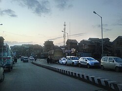 View of Downtown from Zaina Kadal Bridge | |
 Downtown (Srinagar) Location in Jammu and Kashmir, India Show map of Jammu and Kashmir  Downtown (Srinagar) Downtown (Srinagar) (India) Show map of India | |
| Coordinates: 34°5′N 74°47′E / 34.083°N 74.783°E / 34.083; 74.783Coordinates: 34°5′N 74°47′E / 34.083°N 74.783°E / 34.083; 74.783 | |
| District | Srinagar district |
| Settled | Ancient |
| Elevation | 1,585 m (5,200 ft) |
| Languages | |
| • Official | Kashmiri |
| • Official | Urdu |
| Time zone | UTC+5:30 (IST) |
| Distance from Delhi | 837.4 kilometres (520.3 mi)[1] |
| Distance from Mumbai | 2,192.6 kilometres (1,362.4 mi)[2] |
Downtown, popularly known as Shehr-e-Khaas, is a notable area in the municipality of Srinagar. It is the largest and the most densely populated area in the city of Srinagar. The area is mostly located on the banks of Jhelum river about 5 km from city center.[3] The area is considered as the core point in the city as the first inhabitants of the Srinagar lived there. The area reflects the images of old city of Srinagar. The historical buildings and monuments in the area reflect the design of old times. The residential homes are depicted to be constructed from late-19th century to early-20th century. Many key monuments like Jamia Masjid, Khanqah-e-Moula, Maharaj Gangh and shrines have been built famous rulers of Kashmir.
Contents
1 History
2 Geography
3 Demographics
4 Flood
5 Education
6 Features
6.1 Hospitals
6.2 Social Organization
7 Sub divisions
8 See also
9 References
History
The area was settled more than 2000 years ago in 3rd century BC by Raja Pravarsena. The area is the hub of the historical monuments made by the famous rulers of Kashmir.[4] The historical monuments include Jamia Masjid in Nowhatta, Khanqah-e- Moula in Zana Kadal Aali Masjid in Eidgah, Maharaj Ganj tomb in Maharaj Ganj, Pathar (stone) Masjid in Nawabazar, and Sheikh Abdul Qadir Jeelani's shrine in Khanyar. Moreover, the Roza Bal shrine is also situated in the area.
Geography
The area is located at 34°05′00″N 74°47′00″E / 34.0833°N 74.7833°E / 34.0833; 74.7833 at an elevation of 1585 meters above mean sea level in Srinagar.
Demographics
Kashmiri is the main language of the area. People also use Urdu and English as secondary languages. It is estimated that the downtown has the population of half a million which is about 47% of the total population of Srinagar district.[5]
Flood
In September 2014 the state of Jammu and Kashmir was hit by floods caused by torrential rainfall. The area of Downtown was least affected as compared to the rest of Srinagar, though close to the river, the people from other parts of Srinagar shifted to downtown for safety. Commercial buildings and residential homes and Government offices were shattered to nothing in the adjoining areas. People lost their lives and properties and the whole area was set on the economic back-foot. Schools, hospitals and other places of significant importance were damaged by the floods.[6]
Education
There are number of premier school and colleges in downtown.
The area consists of following schools
- Green land Educational Society,Hawal
- Islamia Higher Secondary School, Rajouri Kadal
- City Central Educational Institute, Khanyar
- Sultan-Ul-Arifeen Public School, Botraj Colony
The Colleges are following:
- Islamia College of Science and Commerce, Srinagar
- Sadiq Memorial College of Education
- Women's College, NawaKadal
- Gandhi Memorial College, Srinagar
Computer Institution:
- Cybex Computer Institute Safakadal.
Features
Hospitals
Shri Maharaja Hari Singh (SMSH), Multi-speciality hospital- Jawahar Lal Nehru Memorial JLMN Hospital Rainawari
- Govt Gousia Hospital Khanyar
Kathi Junctuon, Nowhatta
Downtown Cafe, Gojwara
- 7 Days, Nowhatta
Social Organization
- Jammu and Kashmir Innovators Forum
- Social Royal Voluntary Environmental Service
- Idarah Falah Aam Alamgari bazar, Srinagar
- Educational Trust of Kashmir, Srinagar
Sub divisions
The areas which comprising Downtown Srinagar include:-
| S.No | Name | Popularity |
|---|---|---|
| 1 | Nowhatta | High |
| 2 | Rajouri Kadal | High |
| 3 | Gojwara | High |
| 4 | Kawdara | Medium |
| 5 | Saraf Kadal | Medium |
| 6 | Bohri Kadal | High |
| 7 | Nawa Kadal | High |
| 8 | Naid Kadal | Medium |
| 9 | Safa Kadal | High |
| 10 | Khanyar | High |
| 11 | Sekidafar | High |
| 12 | Aali Kadal | Medium |
| 13 | Habba Kadal | High |
| 14 | Fateh Kadal | High |
| 15 | Kani Kadal | Medium |
| 16 | Kadi Kadal | Medium |
| 17 | Dumbe Kadal | Low |
| 18 | Shah Kadal | Low |
| 19 | Nawa Bazaar | High |
| 20 | Maharaj Gunj | High |
| 21 | Zaina Kadal | High |
| 22 | Khanqah e mohalla | High |
| 23 | Gratabal | Low |
| 24 | Tarabal | Low |
| 25 | Braripora | Medium |
| 26 | Bul bul lanker | Low |
| 27 | Narparistan | Low |
| 28 | Khawaja Bazar | Medium |
| 29 | Rainawari | High |
| 30 | Baba Demb | Low |
| 31 | Zaldagar | Low |
| 32 | Malaratta | Medium |
| 33 | Kalashpur | Low |
| 34 | Narwara | Medium |
| 35 | Ganderpora | Low |
| 36 | Eidgah | High |
| 37 | Noor bagh | High |
| 38 | Zanidar Mohalla | Low |
| 39 | Hawal | High |
| 40 | Jamalatta | Low |
See also
- Soura
- Buchpora
References
^ "distance from New Delhi". Retrieved 30 November 2014..mw-parser-output cite.citation{font-style:inherit}.mw-parser-output .citation q{quotes:"""""""'""'"}.mw-parser-output .citation .cs1-lock-free a{background:url("//upload.wikimedia.org/wikipedia/commons/thumb/6/65/Lock-green.svg/9px-Lock-green.svg.png")no-repeat;background-position:right .1em center}.mw-parser-output .citation .cs1-lock-limited a,.mw-parser-output .citation .cs1-lock-registration a{background:url("//upload.wikimedia.org/wikipedia/commons/thumb/d/d6/Lock-gray-alt-2.svg/9px-Lock-gray-alt-2.svg.png")no-repeat;background-position:right .1em center}.mw-parser-output .citation .cs1-lock-subscription a{background:url("//upload.wikimedia.org/wikipedia/commons/thumb/a/aa/Lock-red-alt-2.svg/9px-Lock-red-alt-2.svg.png")no-repeat;background-position:right .1em center}.mw-parser-output .cs1-subscription,.mw-parser-output .cs1-registration{color:#555}.mw-parser-output .cs1-subscription span,.mw-parser-output .cs1-registration span{border-bottom:1px dotted;cursor:help}.mw-parser-output .cs1-ws-icon a{background:url("//upload.wikimedia.org/wikipedia/commons/thumb/4/4c/Wikisource-logo.svg/12px-Wikisource-logo.svg.png")no-repeat;background-position:right .1em center}.mw-parser-output code.cs1-code{color:inherit;background:inherit;border:inherit;padding:inherit}.mw-parser-output .cs1-hidden-error{display:none;font-size:100%}.mw-parser-output .cs1-visible-error{font-size:100%}.mw-parser-output .cs1-maint{display:none;color:#33aa33;margin-left:0.3em}.mw-parser-output .cs1-subscription,.mw-parser-output .cs1-registration,.mw-parser-output .cs1-format{font-size:95%}.mw-parser-output .cs1-kern-left,.mw-parser-output .cs1-kern-wl-left{padding-left:0.2em}.mw-parser-output .cs1-kern-right,.mw-parser-output .cs1-kern-wl-right{padding-right:0.2em}
^ "distance from Mumbai". Retrieved 30 November 2014.
^ "Location of Downtown". Retrieved 30 November 2014.
^ "greater kashmir .com". Archived from the original on 7 December 2014. Retrieved 30 November 2014.
^ "times of india". Retrieved 30 November 2014.
^ "hindustantimes.com". Archived from the original on 7 December 2014. Retrieved 30 November 2014.
Capital: Srinagar (Summer); Jammu (Winter) | |||||||
| History |
| ||||||
| Government and politics |
| ||||||
Culture and places |
| ||||||
Districts and divisions |
| ||||||
| Cities |
| ||||||
| Towns |
| ||||||
| Famous villages |
| ||||||
| Regions |
| ||||||
| Railways |
| ||||||
| Roads |
| ||||||
| Legislative Assembly elections |
| ||||||
| Sports |
| ||||||
| Other topics |
| ||||||


