Sisak-Moslavina County
Sisak-Moslavina County Sisačko-moslavačka županija | |||
|---|---|---|---|
County | |||
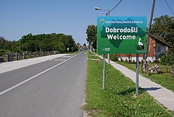 Sign for Sisak-Moslavina County in Hrvatska Dubica | |||
| |||
 Sisak-Moslavina County within Croatia | |||
| Country | Croatia | ||
| County seat | Sisak | ||
| Government | |||
| • Župan | Ivo Žinić (HDZ) | ||
| Area [1] | |||
| • Total | 4,468 km2 (1,725 sq mi) | ||
| Population (2011)[2] | |||
| • Total | 172,439 | ||
| • Density | 39/km2 (100/sq mi) | ||
| Area code | 044 | ||
| ISO 3166 code | HR-03 | ||
HDI (2017) | 0.798[3] high · 14th | ||
| Website | www.smz.hr | ||


Sisak-Moslavina County (Croatian: Sisačko-moslavačka županija) is a Croatian county in eastern Central Croatia and southwestern Slavonia. It is named after the city of Sisak and the region Moslavina just across the river Sava. According to 2011 census it is inhabited by 172,000 people.
This county features the ancient Roman city of Siscia—today's Sisak. Siscia was the largest city of the whole region back then, a Pannonian capital, probably due to its position on the confluence of the Kupa and Sava rivers. The city's patron saint is its first Christian bishop, St. Kvirin, who was tortured and almost killed during Diocletian's persecution of Christians. Legend has it that they tied him to a millstone and threw him into a river, but he freed himself from the weight, escaped and continued to preach his faith.
The town may have lost importance with the fall of one empire, but it recovered it soon enough with the rise of another: Sisak became famous for crucial battles between European armies and the Ottoman Turks. In particular, the battle of 1593 when the Ottoman army first suffered a large defeat. The ban Toma Bakač Erdedi who led the defense in this battle became famous throughout Europe.
Today, Sisak features the largest Croatian metallurgic factory (supported by the University of Zagreb's Faculty of Metallurgy also in the city) and the largest oil refinery. These are coupled with the petrochemical facilities in the nearby town of Kutina, the first recorded mention of which was in 1256 by king Béla IV. Moslavina is probably the most picturesque part of this county, with the natural park Lonjsko polje near the rivers Lonja, Ilova and Pakra.
This county also extends far to the south to the border with Bosnia, and in this southern part of the county one can find a small town of Topusko, which has another one of those spas typical for Central Croatia, although this one stands out with seniority because it dates back to the neolithic age.
Sisak-Moslavina County borders on the Karlovac County in the west, Zagreb County in the north, Bjelovar-Bilogora County and Požega-Slavonia County in the northeast, and finally Brod-Posavina County in the east.
Contents
1 Administrative division
2 Demographics
3 See also
4 References
5 External links
Administrative division
Sisak-Moslavina county is subdivided as follows:
- City of Sisak (county seat)
- Town of Glina
- Town of Hrvatska Kostajnica
- Town of Kutina
- Town of Novska
- Town of Petrinja
- Town of Popovača
- Municipality of Donji Kukuruzari
- Municipality of Dvor
- Municipality of Gvozd
- Municipality of Hrvatska Dubica
- Municipality of Jasenovac
- Municipality of Lekenik
- Municipality of Lipovljani
- Municipality of Majur
- Municipality of Martinska Ves
- Municipality of Sunja
- Municipality of Topusko
- Municipality of Velika Ludina
Demographics
As of the 2011 census, the county had 172,439 residents. The population density is 39 people per km2.
Ethnic Croats form the majority with 82.4% of the population, followed by Serbs at 12.2%.[4]
| Historical populations of Sisak-Moslavina County | |||||||||||||||||||||||||||||||||||||||||||||||||||||||
|---|---|---|---|---|---|---|---|---|---|---|---|---|---|---|---|---|---|---|---|---|---|---|---|---|---|---|---|---|---|---|---|---|---|---|---|---|---|---|---|---|---|---|---|---|---|---|---|---|---|---|---|---|---|---|---|
|
| ||||||||||||||||||||||||||||||||||||||||||||||||||||||
| Source: Naselja i stanovništvo Republike Hrvatske 1857–2001, Croatian Bureau of Statistics, Zagreb, 2005 | |||||||||||||||||||||||||||||||||||||||||||||||||||||||
Population change 1857-2011[5]

See also
- Roman Catholic Diocese of Sisak
- Serbian Orthodox Eparchy of Gornji Karlovac
- Serbian Orthodox Eparchy of Slavonia
References
^ Ostroški, Ljiljana, ed. (December 2015). Statistički ljetopis Republike Hrvatske 2015 [Statistical Yearbook of the Republic of Croatia 2015] (PDF). Statistical Yearbook of the Republic of Croatia (in Croatian and English). 47. Zagreb: Croatian Bureau of Statistics. p. 62. ISSN 1333-3305. Retrieved 27 December 2015..mw-parser-output cite.citation{font-style:inherit}.mw-parser-output .citation q{quotes:"""""""'""'"}.mw-parser-output .citation .cs1-lock-free a{background:url("//upload.wikimedia.org/wikipedia/commons/thumb/6/65/Lock-green.svg/9px-Lock-green.svg.png")no-repeat;background-position:right .1em center}.mw-parser-output .citation .cs1-lock-limited a,.mw-parser-output .citation .cs1-lock-registration a{background:url("//upload.wikimedia.org/wikipedia/commons/thumb/d/d6/Lock-gray-alt-2.svg/9px-Lock-gray-alt-2.svg.png")no-repeat;background-position:right .1em center}.mw-parser-output .citation .cs1-lock-subscription a{background:url("//upload.wikimedia.org/wikipedia/commons/thumb/a/aa/Lock-red-alt-2.svg/9px-Lock-red-alt-2.svg.png")no-repeat;background-position:right .1em center}.mw-parser-output .cs1-subscription,.mw-parser-output .cs1-registration{color:#555}.mw-parser-output .cs1-subscription span,.mw-parser-output .cs1-registration span{border-bottom:1px dotted;cursor:help}.mw-parser-output .cs1-ws-icon a{background:url("//upload.wikimedia.org/wikipedia/commons/thumb/4/4c/Wikisource-logo.svg/12px-Wikisource-logo.svg.png")no-repeat;background-position:right .1em center}.mw-parser-output code.cs1-code{color:inherit;background:inherit;border:inherit;padding:inherit}.mw-parser-output .cs1-hidden-error{display:none;font-size:100%}.mw-parser-output .cs1-visible-error{font-size:100%}.mw-parser-output .cs1-maint{display:none;color:#33aa33;margin-left:0.3em}.mw-parser-output .cs1-subscription,.mw-parser-output .cs1-registration,.mw-parser-output .cs1-format{font-size:95%}.mw-parser-output .cs1-kern-left,.mw-parser-output .cs1-kern-wl-left{padding-left:0.2em}.mw-parser-output .cs1-kern-right,.mw-parser-output .cs1-kern-wl-right{padding-right:0.2em}
^ "Population by Age and Sex, by Settlements, 2011 Census: County of Sisak-Moslavina". Census of Population, Households and Dwellings 2011. Zagreb: Croatian Bureau of Statistics. December 2012.
^ "Sub-national HDI - Area Database - Global Data Lab". hdi.globaldatalab.org. Retrieved 2018-09-13.
^ "Population by Ethnicity, by Towns/Municipalities, 2011 Census: County of Sisak-Moslavina". Census of Population, Households and Dwellings 2011. Zagreb: Croatian Bureau of Statistics. December 2012.
^ Naselja i stanovništvo Republike Hrvatske 1857.-2001., www.dzs.hr
External links
| Wikimedia Commons has media related to Sisak-Moslavina County. |
Official website (in Croatian)
Subdivisions of Sisak-Moslavina County | ||
|---|---|---|
| Cities and towns |
| |
| Municipalities |
| |
Counties of Croatia | ||
|---|---|---|
| ||
Coordinates: 45°13′15″N 16°15′05″E / 45.22083°N 16.25139°E / 45.22083; 16.25139


