Ibaraki, Ibaraki
Ibaraki .mw-parser-output .nobold{font-weight:normal} 茨城町 | |||
|---|---|---|---|
Town | |||
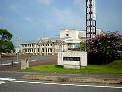 Ibaraki town office | |||
| |||
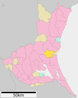 Location of Ibaraki in Ibaraki Prefecture | |||
 Ibaraki | |||
| Coordinates: 36°17′12.8″N 140°25′28.3″E / 36.286889°N 140.424528°E / 36.286889; 140.424528Coordinates: 36°17′12.8″N 140°25′28.3″E / 36.286889°N 140.424528°E / 36.286889; 140.424528 | |||
| Country | Japan | ||
| Region | Kantō | ||
| Prefecture | Ibaraki Prefecture | ||
| District | HIgashiibaraki | ||
| Area | |||
| • Total | 121.58 km2 (46.94 sq mi) | ||
| Population (September 2015) | |||
| • Total | 32,924 | ||
| • Density | 271/km2 (700/sq mi) | ||
| Time zone | UTC+9 (Japan Standard Time) | ||
| - Tree | Prunus mume | ||
| - Flower | Sakura | ||
| - Bird | Japanese bush warbler | ||
| Phone number | 029-292-1111 | ||
| Address | 1080 Ozutsumi, Ibaraki-machi, Higashiibaraki-gun, Ibaraki-ken 311-3192 | ||
| Website | http://www.town.ibaraki.lg.jp/ | ||


Ibaraki (茨城町, Ibaraki-machi) is a town located in Ibaraki Prefecture, Japan. As of September 2015, the town had an estimated population of 32,924, and a population density of 271 persons per km2. Its total area is 121.58 km2.
Contents
1 Geography
2 Surrounding municipalities
3 History
4 Economy
5 Education
6 Transportation
6.1 Railway
6.2 Highway
7 Local attractions
8 External links
Geography
Located in central Ibaraki Prefecture, Ibaraki is located in the flatlands near the Pacific Ocean, and almost encompasses Lake Hinuma, the 30th largest body of freshwater in Japan.
Surrounding municipalities
Ibaraki Prefecture
- Mito
- Omitama
- Kasama
- Hokota
- Ōarai
History
The villages of Nagaoka, Kawane, Kaminoai and Ishizaki were created within Higashiibaraki District and the village of Numasaki was created within Kashima District with the establishment of the municipalities system on April 1, 1889. Nagaoka was elevated to town status on February 11, 1955 and merged with Kawane and Kaminoai to form the town of Ibaraki the same day. Ibaraki annexed neighboring Ishizaki on March 5, 1958.
The town was set to merge with Mito, on December 8, 2007, but following the election of a new mayor in April 2007, these plans were abandoned.
Economy
Education
- Ibaraki has six elementary schools, two middle schools and one high school.
Transportation
Railway
- Ibaraki is not served by any passenger train service.
Highway
Kita-Kantō Expressway – Ibarakimachi-Nishi IC, Ibarakimachi JCT, Ibarakimachi-Higashi IC
Higashi-Kantō Expressway – Ibaraki Kuko Kita IC, Ibarakimachi IC- Japan National Route 6
Local attractions
- Hinuma Hydrangea Festival
- Ibaraki Festival
External links
![]() Media related to Ibaraki, Ibaraki at Wikimedia Commons
Media related to Ibaraki, Ibaraki at Wikimedia Commons
Official Website (in Japanese)
Mito (capital) | ||
| Special cities |
| |
| Cities |
| |
| Districts |
| |
List of mergers in Ibaraki Prefecture | ||
Authority control |
|
|---|


