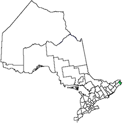
Glengarry County, Ontario
Glengarry County | |
|---|---|
 Glengarry located within Ontario | |
| Country | Canada |
| Province | Ontario |
Glengarry County, an area covering 288,688 acres (1,168 km2), is a county in the Canadian province of Ontario. It is historically known for its settlement of Scottish Highlanders. Glengarry County now consists of the modern-day townships of North Glengarry and South Glengarry and it borders the Saint Lawrence River.
Glengarry was founded in 1784 by Scottish loyalists, mainly from Clan MacDonell, and other Highland Scottish emigrants from the Mohawk Valley in New York. The Crown granted them land and helped with supplies the first winter, as compensation for their losses in New York. Some veterans received land instead of pay for their salaries. In addition, the settlement was founded as a destination for Scottish emigrants arriving after the recent Highland Clearances. Great Britain hoped the new immigrants would help settle and develop this area, which became known as Upper Canada and later Ontario. Throughout the late 18th and the 19th century, other Highland emigrants settled into the community as a means of preserving their Scottish Highland Culture. The county was named after the Scottish Glen, where the MacDonnell family was based. The Glengarry Highland Games are an example of the county's historic culture, first celebrated in 1948. They have been held annually since, during the weekend before the first Monday in August. These Games are one of the largest of their kind outside Scotland. The original territory of Glengarry also included Prescott County, which became a separate county in 1800.[citation needed]
Canadian Gaelic (i.e. Scottish Gaelic) used to be a common language in this region.[1] Though the number of speakers has steadily decreased over the past years, those wanting to learn Gaelic form classes throughout Glengarry.
Glengarry later united with Stormont and Dundas to form the regional government United Counties of Stormont, Dundas and Glengarry.
Contents
1 Historic townships
2 See also
3 References
4 External links
Historic townships
Glengarry was originally divided east and west into Charlottenburg and Lancaster townships, and then eventually divided into four townships. Since it has been divided into North and South Glengarry.
Charlottenburgh – now in South Glengarry Township, it was named in honour of Queen Charlotte.
Kenyon – now in North Glengarry Township. Kenyon Township was taken from Charlottenburg Township in 1798, and was named from the English Chief Justice Lloyd Kenyon, 1st Baron Kenyon
Lancaster – now in South Glengarry Township. Surveyed in 1784, it was first settled in 1785.
Lochiel – now in North Glengarry. Lochiel Township separated from Lancaster Township on November 24, 1818. Lochiel was named after the chief of the Clan Cameron. This clan had many representatives among the veteran settlers.[2]
See also
- List of Ontario census divisions
- List of townships in Ontario
- Canadian Gaelic
References
^ J. A. (John Alexander) Macdonnell, Sketches Illustrating the Early Settlement and History of Glengarry in Canada, p. 150, Montreal: W. Foster, Brown & Co., 1893
^ Province of Ontario -- A History 1615 to 1927 by Jesse Edgar Middletwon & Fred Landon, copyright 1927, Dominion Publishing Company, Toronto
External links
- Township of South Glengarry
- Township of North Glengarry
- Glengarry County Map (1879)
Coordinates: 45°15′N 74°35′W / 45.250°N 74.583°W / 45.250; -74.583