Tanchon
Tanchon .mw-parser-output .nobold{font-weight:normal} 단천시 | |
|---|---|
| Municipal City | |
| Korean transcription(s) | |
| • Chosŏn'gŭl | 단천시 |
| • Hancha | 端川市 |
| • McCune-Reischauer | Tanch'ŏn si |
| • Revised Romanization | Dancheon-si |
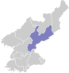
 Map of South Hamgyong showing the location of Tanchon | |
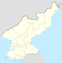 Tanchon Map of North Korea showing the location of Tanchon | |
| Coordinates: 40°27′29″N 128°54′40″E / 40.458°N 128.911°E / 40.458; 128.911Coordinates: 40°27′29″N 128°54′40″E / 40.458°N 128.911°E / 40.458; 128.911 | |
| Country | North Korea |
| Province | South Hamgyong Province |
| Administrative divisions | 39 tong, 39 ri |
| Area | |
| • Total | 2,170 km2 (840 sq mi) |
| Population (est.) | |
| • Total | 360,000 |
Tanch'ŏn (Korean pronunciation: [tan.tsʰʌn]) is a port city in northeastern South Hamgyŏng province, North Korea. It has a population of approximately 360,000. Tanch'ŏn borders the Sea of Japan (East Sea of Korea), into which the Namdae River flows.
Contents
1 Administrative divisions
2 Economy
3 Transport
4 Wildlife
5 Climate
6 See also
7 References
8 Further reading
9 External links
Administrative divisions
Tanch'ŏn is divided into 39 tong (neighbourhoods) and 39 ri (villages):
|
|
Economy
There are extensive mineral resources in the area, including cobalt, magnesite, and iron ore.
The city is known for its chemical production, textiles, metal ware, machinery and smelting.
- Technology
The City of Tanch'ŏn is featured in the PC game Tradewinds.
Transport
Tanch'ŏn is situated on the P'yŏngra Line and the Hŏch'ŏn Line of the Korean State Railway.[1] In 2012 the city's port was renovated and upgraded.[2] Tanch'ŏn port was reconstructed, and a ceremony marking the completion was taken place in December 2012. In the ceremony, a joint congratulatory message sent by the Central Committee of the Workers’ Party of Korea and the Cabinet was read to the officials and members of shock brigades who performed labor feats in the construction of the port.[3]
Wildlife
The population of Chinese Gorals in Tanch'ŏn has been designated North Korean natural monument #293.[4]
Climate
Tanchon has a humid continental climate (Köppen climate classification: Dwa).
| Climate data for Tanchon | |||||||||||||
|---|---|---|---|---|---|---|---|---|---|---|---|---|---|
| Month | Jan | Feb | Mar | Apr | May | Jun | Jul | Aug | Sep | Oct | Nov | Dec | Year |
| Average high °C (°F) | 1.1 (34) | 2.4 (36.3) | 6.9 (44.4) | 13.5 (56.3) | 18.2 (64.8) | 20.9 (69.6) | 24.8 (76.6) | 26.0 (78.8) | 22.9 (73.2) | 17.7 (63.9) | 10.1 (50.2) | 3.4 (38.1) | 14 (57.2) |
| Daily mean °C (°F) | −4.4 (24.1) | −3.0 (26.6) | −1.8 (28.8) | 7.6 (45.7) | 12.4 (54.3) | 16.1 (61) | 20.6 (69.1) | 22.0 (71.6) | 17.9 (64.2) | 11.9 (53.4) | 4.9 (40.8) | −1.7 (28.9) | 8.5 (47.4) |
| Average low °C (°F) | −9.8 (14.4) | −8.3 (17.1) | −3.2 (26.2) | 1.7 (35.1) | 6.7 (44.1) | 11.4 (52.5) | 16.5 (61.7) | 18.1 (64.6) | 13.0 (55.4) | 6.2 (43.2) | −0.3 (31.5) | −6.8 (19.8) | 3.8 (38.8) |
| Average precipitation mm (inches) | 23 (0.91) | 18 (0.71) | 24 (0.94) | 37 (1.46) | 53 (2.09) | 83 (3.27) | 129 (5.08) | 156 (6.14) | 108 (4.25) | 45 (1.77) | 47 (1.85) | 27 (1.06) | 750 (29.53) |
| Source: Climate-Data.org [5] | |||||||||||||
See also
- Administrative divisions of North Korea
- Geography of North Korea
- South Hamgyong
References
^ Kokubu, Hayato, 将軍様の鉄道 (Shōgun-sama no Tetsudō), .mw-parser-output cite.citation{font-style:inherit}.mw-parser-output q{quotes:"""""""'""'"}.mw-parser-output code.cs1-code{color:inherit;background:inherit;border:inherit;padding:inherit}.mw-parser-output .cs1-lock-free a{background:url("//upload.wikimedia.org/wikipedia/commons/thumb/6/65/Lock-green.svg/9px-Lock-green.svg.png")no-repeat;background-position:right .1em center}.mw-parser-output .cs1-lock-limited a,.mw-parser-output .cs1-lock-registration a{background:url("//upload.wikimedia.org/wikipedia/commons/thumb/d/d6/Lock-gray-alt-2.svg/9px-Lock-gray-alt-2.svg.png")no-repeat;background-position:right .1em center}.mw-parser-output .cs1-lock-subscription a{background:url("//upload.wikimedia.org/wikipedia/commons/thumb/a/aa/Lock-red-alt-2.svg/9px-Lock-red-alt-2.svg.png")no-repeat;background-position:right .1em center}.mw-parser-output .cs1-subscription,.mw-parser-output .cs1-registration{color:#555}.mw-parser-output .cs1-subscription span,.mw-parser-output .cs1-registration span{border-bottom:1px dotted;cursor:help}.mw-parser-output .cs1-hidden-error{display:none;font-size:100%}.mw-parser-output .cs1-visible-error{font-size:100%}.mw-parser-output .cs1-subscription,.mw-parser-output .cs1-registration,.mw-parser-output .cs1-format{font-size:95%}.mw-parser-output .cs1-kern-left,.mw-parser-output .cs1-kern-wl-left{padding-left:0.2em}.mw-parser-output .cs1-kern-right,.mw-parser-output .cs1-kern-wl-right{padding-right:0.2em}
ISBN 978-4-10-303731-6
^ ""Tanchon Port reconstruction completed", NK Economy Watch". Archived from the original on 2012-05-29.
^ "Tanchon Port reconstruction completed". North Korea Leadership Watch. Archived from the original on 22 March 2013. Retrieved 25 April 2013.
^ "단천산양". Cultural Heritage Administration guide to North Korean natural monuments. Archived from the original on 2007-09-30. Retrieved 2006-12-01.
^ "Climate: Tanchon". Climate-Data.org. Retrieved July 26, 2018.
Further reading
- Dormels, Rainer. North Korea's Cities: Industrial facilities, internal structures and typification. Jimoondang, 2014.
ISBN 978-89-6297-167-5
External links
(in Korean) In Korean language online encyclopedias:
- Doosan Encyclopedia (Naver)
Korean language Britannica (Empas) (Map)- Encyclopedia of Korean Culture (Empas)
- Pascal World Encyclopedia (Nate)
- City profile of Tanchon
South Hamgyong Province | ||
|---|---|---|
| Capital |
|  |
| Cities |
| |
| Districts |
| |
| Counties |
| |
This North Korea location article is a stub. You can help Wikipedia by expanding it. |


