Alberton, Gauteng
Alberton | |
|---|---|
 Alberton Boulevard | |
 Alberton Show map of Gauteng  Alberton Show map of South Africa | |
| Coordinates: 26°16′02″S 28°07′19″E / 26.26722°S 28.12194°E / -26.26722; 28.12194Coordinates: 26°16′02″S 28°07′19″E / 26.26722°S 28.12194°E / -26.26722; 28.12194 | |
| Country | South Africa |
| Province | Gauteng |
| Municipality | Ekurhuleni |
| Area [1] | |
| • Total | 77.16 km2 (29.79 sq mi) |
| Elevation | 1,570 m (5,150 ft) |
| Population (2011)[1] | |
| • Total | 121,536 |
| • Density | 1,600/km2 (4,100/sq mi) |
| Racial makeup (2011) [1] | |
| • Black African | 26.5% |
| • Coloured | 14.4% |
| • Indian/Asian | 4.9% |
| • White | 53.2% |
| • Other | 0.9% |
First languages (2011) [1] | |
| • Afrikaans | 42.4% |
| • English | 34.6% |
| • Zulu | 6.9% |
| • Sotho | 5.1% |
| • Other | 11.0% |
| Time zone | UTC+2 (SAST) |
Postal code (street) | 1447 up to 1458, 1481 |
| PO box | 1450 |
| Area code | 010 |
| Website | www.alberton.co.za |
Alberton is a city situated on the southern part of the East Rand of the Gauteng Province in South Africa. It was incorporated into the Ekurhuleni metropolitan municipality in the year 2000 and celebrated its centenary year in 2005. According to the 2011 census conducted by Statistics South Africa, it has a population of 121,536; but this figure excludes the black township of Thokoza, which has a polupation of 105,827. Alberton is described as a typical bedroom community, one which is primarily residential in character, with most of its workers commuting to work in nearby suburbs or cities. The town has multiple access roads to all major freeways in Gauteng and is situated on the banks of the Natal Spruit close to the major urban centres of Johannesburg, which lies 15 km (9 mi) to the northwest - and Pretoria - which is 76 km (47 mi) to the north. Alberton has an elevation of approximately 1,570 m (5,150 ft) above sea level.
Contents
1 History
2 Geography
2.1 Cityscape
2.2 Suburbs
3 Sports
4 Parks and greenspace
5 Infrastructure
5.1 Health
6 Notable residents (past and present)
7 Gallery
8 References
9 External links
History

Org Meyer's Grave
In the early 1840's, the Voortrekkers Johan Georg (Org) Meyer and Hester Catharina Elizabeth (néé Mulder) arrived in the Transvaal after moving from their home in Prince Albert, in what was then the Cape Colony. [2]
Org sourced land and selected three farms, namely Klipriviersberg, Elandsfontein and Swartkoppies. In 1856, Johannes Petrus Meyer (better known as Jan Meyer) acquired 11 hectares (27 acres) of his father's Elandsfontein farm and built a house next to the Natalspruit, close to where the civic centre stands today. In 1890, he built a new farmhouse mansion on the opposite end of the farm that was miraculously left unharmed during the Anglo Boer War of 1899–1902. The homestead can still be seen today from the bypassing N12 freeway. Jan's brother, also Johan Georg (Org) Meyer, took over the farm after Jan's death. General Hendrik Abraham Alberts, a veteran of the Anglo Boer War, purchased a part of the farm from Org in 1904 and named it Alberton.[3]
The Afrikaans medium primary school Jan Meyer was named for the original owner of the farm, and the affluent suburb Meyersdal also refers to the family whose original farmhouse mansion still stands on the land behind the Meyersdal koppie. The primary school Generaal Alberts, and Hennie Alberts Avenue in the suburb of Brackenhurst, are named after the town founder.
The first official post office was opened in 1926, and in 1938 building work started on a town hall. In the same year, street names in the Alberton North suburb were renamed after Voortrekker leaders to coincide with the 100 year commemoration of the Great Trek. A well-known landmark of the city, The Blue Mill, was established in 1943 in Pieter Uys Avenue, Alberton North, and is still trading today as a general store specializing in sporting goods.
Geography
Cityscape
The town's initial centre of development was in the area now known as Alberton North or ‘Old’ Alberton. The original black settlement in Alberton was in the area of the Alberton Dam. During the apartheid era, inhabitants were moved to the surrounding black townships and a 'white' suburb was established around the dam and named Verwoerdpark, after former prime minister Hendrik Verwoerd. Over the years, development sprawled out into adjacent areas, and today Alberton is made up of 19 suburbs stretching over an area of 77km2.
Suburbs
- Alberante
- Albertsdal
- Alberton North
- Alrode
- Brackendowns
- Brackenhurst
- Eden Park
- Florentia
- General Alberts Park
- Mayberry Park
- Meyersdal
- New Redruth
- Newmarket Park
- Palm Ridge
- Raceview
- Randhart
- South Crest
- Thokoza
- Verwoerdpark
Alrode, which is Alberton's industrial suburb, was established in 1943. One of the most notable industries to be established in the town during this time was CJ Fuchs (Pty) Ltd. Venturing into the production of domestic electrical appliances under licence from the American company Westing House Electric International, the business was relocated from central Johnnesburg to a newly-built, modern factory in Alrode in 1948. Until the mid-seventies, CJ Fuchs (Pty) Ltd would continue to grow into a multi-million Rand operation, employing thousands of people in several subsidiary companies within the group. After Carl Fuchs' death in April 1976, the company was sold to the then Barlow Rand. In 1973, he was also the first to be admitted as a Freeman of the Town of Alberton[4].
The construction of the Alberton Boulevard was a major development started in the late 1980s with the aim of converting a section of Voortrekker Road that runs past the Alberton City Shopping Mall into a pedestrian-friendly zone.
Sports
There are many well-established sports facilities and clubs for tennis, rugby, road running[5], boxing, wrestling, cricket, jukskei, netball, hockey, soccer, bowls, korfball and ring tennis in Alberton.
It is also home to the Reading Country Club and Golf Course.
Alberton was also home to the now defunct New Market Race Course, which is now a shopping mall.
Parks and greenspace
Alberton borders on the Klipriviersberg Nature Reserve, located on Peggy Vera Road, Kibler Park, Gauteng (26°18′13″S 28°0′39″E). This reserve is home to many wild animals, including zebra, red hartebeest, porcupines, black wildebeest, otters, blesbok, springbok, duiker and 170 bird species.
There are also Iron Age settlements dating from about 1500 and the ruins of a house built in 1850 by voortrekker Sarel Marais.[6]


Infrastructure
Health
Healthcare facilities include numerous government clinics as well the privately run Union Hospital and Clinton Clinic.
Notable residents (past and present)
Japie Mulder (Springbok rugby player)
Arnold Vosloo (Actor)
Carl Niehaus (Politician)
Andrew Hall (Protea cricketer)
André Pretorius (Springbok rugby player)
Bernadette Coston (Protea and Olympian hockey player )
Malcolm Marx (Springbok rugby player)
Ruan Combrinck (Springbok rugby player)
Gert van der Merwe (Paralympic athlete)
Gallery

Civic Centre looking west

Civic Centre from Alberton City rooftop

Alberton main post office
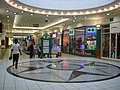
Alberton City shopping centre circa 2010

Old town hall
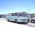
Bus Station circa 1977

Royal York high-rise

Dutch Reformed Church (Eeufeeskerk)

The Blue Mill

Banks of the Natalspruit

Reading interchange at R59 Sybrand van Niekerk/Southern Bypass

Alberton rugby stadium, 2018


References
^ abcd "Main Place Alberton". Census 2011..mw-parser-output cite.citation{font-style:inherit}.mw-parser-output q{quotes:"""""""'""'"}.mw-parser-output code.cs1-code{color:inherit;background:inherit;border:inherit;padding:inherit}.mw-parser-output .cs1-lock-free a{background:url("//upload.wikimedia.org/wikipedia/commons/thumb/6/65/Lock-green.svg/9px-Lock-green.svg.png")no-repeat;background-position:right .1em center}.mw-parser-output .cs1-lock-limited a,.mw-parser-output .cs1-lock-registration a{background:url("//upload.wikimedia.org/wikipedia/commons/thumb/d/d6/Lock-gray-alt-2.svg/9px-Lock-gray-alt-2.svg.png")no-repeat;background-position:right .1em center}.mw-parser-output .cs1-lock-subscription a{background:url("//upload.wikimedia.org/wikipedia/commons/thumb/a/aa/Lock-red-alt-2.svg/9px-Lock-red-alt-2.svg.png")no-repeat;background-position:right .1em center}.mw-parser-output .cs1-subscription,.mw-parser-output .cs1-registration{color:#555}.mw-parser-output .cs1-subscription span,.mw-parser-output .cs1-registration span{border-bottom:1px dotted;cursor:help}.mw-parser-output .cs1-hidden-error{display:none;font-size:100%}.mw-parser-output .cs1-visible-error{font-size:100%}.mw-parser-output .cs1-subscription,.mw-parser-output .cs1-registration,.mw-parser-output .cs1-format{font-size:95%}.mw-parser-output .cs1-kern-left,.mw-parser-output .cs1-kern-wl-left{padding-left:0.2em}.mw-parser-output .cs1-kern-right,.mw-parser-output .cs1-kern-wl-right{padding-right:0.2em}
^ "Alberton 110 years old: In the beginning there were only farms | Alberton Record". Alberton Record. 2014-07-29. Retrieved 2018-11-13.
^ Raper, Peter E.; Moller, Lucie A.; du Plessis, Theodorus L. (2014). Dictionary of Southern African Place Names. Jonathan Ball Publishers. p. 1412. ISBN 9781868425501.
^ "The Fuchs Foundation - Our History". www.fuchsfoundation.co.za. Retrieved 2018-11-13.
^ "Alberton Amateur Athletic Club". www.albertonroadrunners.co.za. Retrieved 2018-11-13.
^ "The reserve is steeped in history and an abundance of fauna and flora. | Alberton Record". albertonrecord.co.za. Retrieved 2017-04-12.
External links
- Alberton web site
- Alberton Blogging and Community web site
- Alberton Online Community Forum and Business Directory
| Wikimedia Commons has media related to Alberton, Gauteng. |
Communities of Ekurhuleni, Gauteng | ||
|---|---|---|
Seat: Germiston | ||
| Places in Ekurhuleni |
|  |


