Noughaval (civil parish)
Noughaval Nuachabháil | |
|---|---|
Civil parish | |
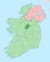
 Noughaval Location of Noughaval within County Westmeath and County Longford in the Republic of Ireland | |
| Coordinates: 53°31′59″N 7°47′54″W / 53.53306°N 7.79833°W / 53.53306; -7.79833Coordinates: 53°31′59″N 7°47′54″W / 53.53306°N 7.79833°W / 53.53306; -7.79833 | |
| Country | |
| Province | Leinster |
| County | County Westmeath and County Longford |
| Irish grid reference | N112524 |
Noughaval (Irish: Nuachabháil)[1] is a civil parish which spans the counties of Longford and Westmeath in Ireland. It is located about 30.02 kilometres (19 mi) west of Mullingar and 21.61 kilometres (13 mi) south of Longford.
Description
Noughaval is one of 4 civil parishes in the barony of Kilkenny West and one of 8 civil parishes in the barony of Shrule, both in the Province of Leinster. The civil parish covers 15,218.6 acres (61.587 km2) , 11,645.1 acres (47.126 km2) in County Westmeath and 3,573.5 acres (14.461 km2) in County Longford.
Noughaval civil parish comprises 41 townlands in County Westmeath and the village of Ballymahon and 10 townlands in County Longford.
County Westmeath: Aghafin, Aghanapisha, Ardnacrany North, Ardnacrany South, Ballynalone, Bawn, Brackagh, Cannorstown (Chapman), Cannorstown (Hogan), Carrick, Cartron, Cartroncroy, Cloghannagarragh, Clogher, Clonkeen, Coolaleena, Coolvin, Corbrack, Corlis, Creggan, Creggy, Doonamona, Doonis, Gortmore, Inchbofin, Inchturk, Kilcornan, Kippin, Lecade, Lisdossan, Lissaquill, Lissoy, Maghera, Muckanagh, Nicholastown, Noughaval, Rath Lower, Rath Upper, Ross, Streamstown and Tonlegee.
County Longford: Annagh, Carrickbeg, Cartron, Clooncullen, Creevagh Beg, Creevaghmore, Garrynagh, Keel, Keelbaun and Rathmore.
Note: The Longford townland of Annagh is in the barony of Rathcline.
The neighbouring civil parishes are: Forgney (County Longford) to the north, Ballymore to the east, Bunown, Drumraney and Kilkenny West to the south, and Shrule (Longford) to the west and north.[2][3][4][5]
References
^ Noughaval civil parish The Placenames Database of Ireland. Retrieved on 26 July 2015.
^ Noughaval civil parish, Co. Westmeath townlands.ie Retrieved on 26 July 2015.
^ Civil Parish of Noughaval, Co. Longford townlands.ie Retrieved on 26 July 2015.
^ Noughaval civil parish, Co. Westmeath The IreAtlas Townland Data Base. Retrieved on 26 July 2015.
^ Noughaval civil parish, Co. Longford The IreAtlas Townland Data Base. Retrieved on 26 July 2015.
External links
Noughaval civil parish at the IreAtlas Townland Data Base
Noughaval civil parish, County Westmeath at townlands.ie
Noughaval civil parish, County Longford at townlands.ie
Noughaval civil parish, County Westmeath at The Placenames Database of Ireland
Noughaval civil parish, County Longford at The Placenames Database of Ireland
Places in County Westmeath | ||
|---|---|---|
County town: Mullingar | ||
| Towns |
|  |
| Villages |
| |
| Baronies |
| |
| ||
Places in County Longford | ||
|---|---|---|
County town: Longford | ||
| Towns |
|  |
| Villages and Townlands |
| |
| ||
This article related to the geography of County Westmeath, Ireland is a stub. You can help Wikipedia by expanding it. |
This article related to the geography of County Longford, Ireland is a stub. You can help Wikipedia by expanding it. |


