Tokchon
Tŏkch'ŏn .mw-parser-output .nobold{font-weight:normal} 덕천 | |
|---|---|
Municipal City | |
| Korean transcription(s) | |
| • Chosŏn'gŭl | 덕천시 |
| • Hancha | 德川市 |
| • McCune–Reischauer | Tŏkch'ŏn-si |
| • Revised Romanization | Deokcheon-si |
 | |
| Coordinates: 39°45′40″N 126°18′43″E / 39.761°N 126.312°E / 39.761; 126.312Coordinates: 39°45′40″N 126°18′43″E / 39.761°N 126.312°E / 39.761; 126.312 | |
| Country | North Korea |
| Province | South P'yŏngan |
| Administrative divisions | 22 tong, 10 ri |
| Population (2009) | |
| • Total | 237,133 |
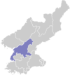
Tŏkch'ŏn (Korean pronunciation: [tʌk̚.tsʰʌn]) is a si, or city, in northern South P'yŏngan province, North Korea. It is bordered by Nyŏngwŏn and Maengsan to the east, Kujang county in North P'yŏngan province to the north, Kaech'ŏn to the west and Pukch'ang to the south. It was known as "Tokugawa" during Japanese rule.
Contents
1 History
2 Administrative divisions
3 Economy
4 Transportation
5 See also
6 Further reading
7 References
8 External links
History
On April 28, 2017, a Hwasong-12 intermediate-range ballistic missile launched from near Pukchang Airport reportedly crashed into Ch'ŏngsin-dong, Tokchon, damaging several structures in the city.[1]
Administrative divisions
Tŏkch'ŏn-si is divided into 22 tong (neighbourhoods) and 10 ri (villages):
|
|
Economy
The Sŭngri Motor Plant (with associated workshops) has been one of the few domestic sources of both low-cost replicas of foreign passenger cars and military-service trucks in North Korea since it was established in 1950, and developed through the massive militarization campaigns of Kim Il-sung in the 1970s and 80s.
However, the total depletion of foreign credit by the end of the 1980s caused the manufacturing industry to implode; the supply of steel for metalworking at Sŭngri slowed to a trickle, and even when available, the production lines had regular power outages. The severe famine in the countryside had also caused an exodus of starving peasants to the cities, further straining food supplies and worker productivity. 20,000 cars and trucks were made in Tŏkch'ŏn in 1980, by 1996 the number was just 150, all of which were Army trucks, some later modified as rocket artillery launchers.[2]
Transportation
Tŏkch'ŏn-si is served by the Korean State Railway's P'yŏngdŏk line and five branchlines.
See also
- List of secondary subdivisions of North Korea
- Geography of North Korea
- South Pyongan
Further reading
- Dormels, Rainer. North Korea's Cities: Industrial facilities, internal structures and typification. Jimoondang, 2014. .mw-parser-output cite.citation{font-style:inherit}.mw-parser-output .citation q{quotes:"""""""'""'"}.mw-parser-output .citation .cs1-lock-free a{background:url("//upload.wikimedia.org/wikipedia/commons/thumb/6/65/Lock-green.svg/9px-Lock-green.svg.png")no-repeat;background-position:right .1em center}.mw-parser-output .citation .cs1-lock-limited a,.mw-parser-output .citation .cs1-lock-registration a{background:url("//upload.wikimedia.org/wikipedia/commons/thumb/d/d6/Lock-gray-alt-2.svg/9px-Lock-gray-alt-2.svg.png")no-repeat;background-position:right .1em center}.mw-parser-output .citation .cs1-lock-subscription a{background:url("//upload.wikimedia.org/wikipedia/commons/thumb/a/aa/Lock-red-alt-2.svg/9px-Lock-red-alt-2.svg.png")no-repeat;background-position:right .1em center}.mw-parser-output .cs1-subscription,.mw-parser-output .cs1-registration{color:#555}.mw-parser-output .cs1-subscription span,.mw-parser-output .cs1-registration span{border-bottom:1px dotted;cursor:help}.mw-parser-output .cs1-ws-icon a{background:url("//upload.wikimedia.org/wikipedia/commons/thumb/4/4c/Wikisource-logo.svg/12px-Wikisource-logo.svg.png")no-repeat;background-position:right .1em center}.mw-parser-output code.cs1-code{color:inherit;background:inherit;border:inherit;padding:inherit}.mw-parser-output .cs1-hidden-error{display:none;font-size:100%}.mw-parser-output .cs1-visible-error{font-size:100%}.mw-parser-output .cs1-maint{display:none;color:#33aa33;margin-left:0.3em}.mw-parser-output .cs1-subscription,.mw-parser-output .cs1-registration,.mw-parser-output .cs1-format{font-size:95%}.mw-parser-output .cs1-kern-left,.mw-parser-output .cs1-kern-wl-left{padding-left:0.2em}.mw-parser-output .cs1-kern-right,.mw-parser-output .cs1-kern-wl-right{padding-right:0.2em}
ISBN 978-89-6297-167-5
References
^ Panda, Ankit; Schmerler, Dave (January 3, 2018). "When a North Korean Missile Accidentally Hit a North Korean City". The Diplomat. Archived from the original on January 4, 2018. Retrieved January 4, 2018.On April 28, 2017, North Korea launched a single Hwasong-12/KN17 intermediate-range ballistic missile (IRBM) from Pukchang Airfield in South Pyongan Province (the Korean People’s Army’s Air and Anti-Air Force Unit 447 in Ryongak-dong, Sunchon City, to be more precise). That missile failed shortly after launch and crashed in the Chongsin-dong, in North Korean city of Tokchon, causing considerable damage to a complex of industrial or agricultural buildings.
^ https://fas.org/nuke/guide/dprk/facility/tokchon.htm
External links
(in Korean) In Korean language online encyclopedias:
- Doosan Encyclopedia (Encyber)
Korean language Britannica (Empas) (Map)- Encyclopedia of Korean Culture (Empas)
- Pascal World Encyclopedia (Nate)
- City profile of Tokchon
Largest cities or towns in North Korea 2008 Census[1] | |||||||||
|---|---|---|---|---|---|---|---|---|---|
Rank | Name | Administrative division | Pop. | Rank | Name | Administrative division | Pop. | ||
 Pyongyang  Hamhung | 1 | Pyongyang | Pyongyang Capital City | 3,255,288 | 11 | Sunchon | South Pyongan | 297,317 |  Chongjin  Nampo |
| 2 | Hamhung | South Hamgyong | 768,551 | 12 | Pyongsong | South Pyongan | 284,386 | ||
| 3 | Chongjin | North Hamgyong | 667,929 | 13 | Haeju | South Hwanghae | 273,300 | ||
| 4 | Nampo | South Pyongan Province | 366,815 | 14 | Kanggye | Chagang | 251,971 | ||
| 5 | Wonsan | Kangwon | 363,127 | 15 | Anju | South Pyongan | 240,117 | ||
| 6 | Sinuiju | North Pyongan | 359,341 | 16 | Tokchon | South Pyongan | 237,133 | ||
| 7 | Tanchon | South Hamgyong | 345,875 | 17 | Kimchaek | North Hamgyong | 207,299 | ||
| 8 | Kaechon | South Pyongan | 319,554 | 18 | Rason | Rason Special Economic Zone | 196,954 | ||
| 9 | Kaesong | North Hwanghae | 308,440 | 19 | Kusong | North Pyongan | 196,515 | ||
| 10 | Sariwon | North Hwanghae | 307,764 | 20 | Hyesan | Ryanggang | 192,680 | ||
This North Korea location article is a stub. You can help Wikipedia by expanding it. |
^ United Nations Statistics Division; 2008 Census of Population of the Democratic People’s Republic of Korea conducted on 1–15 October 2008 Retrieved on 2009-03-18.
