Say, Niger
Say | |
|---|---|
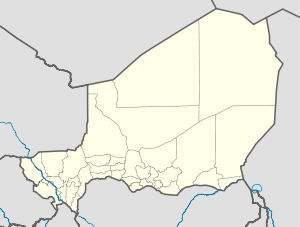 Say Location in Niger | |
| Coordinates: 13°06′N 2°22′E / 13.100°N 2.367°E / 13.100; 2.367 | |
| Country | |
| Region | Tillabéri Region |
| Department | Say Department |
| Elevation | 180 m (590 ft) |
| Population (2011) | |
| • Total | 61,960 |
Say is a town in southwest Niger, situated on the Niger River. It is the capital of the Say Department in the Tillabéri Region. The municipality has 12,000 inhabitants, and its economy is dominated by agriculture, herding and small trade.
Contents
1 Overview
2 Mining
3 Transport
4 Gallery
5 See also
6 References
7 External links
Overview

The Niger River at Say in the 1850s
The town houses the Islamic University of Niger (Université Islamique de Say), an institute of international scope, whose founding was decided following a meeting of the Organisation of the Islamic Conference in 1974, but that opened only in 1986. In 1996, it had 400 students, who paid fees much lower than those of the University of Niamey.[1] In Say there is also a forty-year-old College of Secondary Education (Collège d'enseignement secondaire), with nine teachers and 675 students.[2]
Mining
Say is the location of some potential iron ore mines with reserves of about 650MT.[1][2]
Transport
An extension of the railway from Benin to Niamey is proposed which would serve the iron ore mines at Say.
Gallery
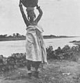
Woman from Say, 1898
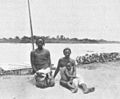
People of Say, 1898

People of Say, 1898
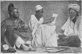
Marabouts of Say, 1912


See also
- Iron ore in Africa
References
^ www.oecd.org: dataoecd
^ Niger-MINING
External links
 Chisholm, Hugh, ed. (1911). . Encyclopædia Britannica. 24 (11th ed.). Cambridge University Press. p. 276..mw-parser-output cite.citation{font-style:inherit}.mw-parser-output .citation q{quotes:"""""""'""'"}.mw-parser-output .citation .cs1-lock-free a{background:url("//upload.wikimedia.org/wikipedia/commons/thumb/6/65/Lock-green.svg/9px-Lock-green.svg.png")no-repeat;background-position:right .1em center}.mw-parser-output .citation .cs1-lock-limited a,.mw-parser-output .citation .cs1-lock-registration a{background:url("//upload.wikimedia.org/wikipedia/commons/thumb/d/d6/Lock-gray-alt-2.svg/9px-Lock-gray-alt-2.svg.png")no-repeat;background-position:right .1em center}.mw-parser-output .citation .cs1-lock-subscription a{background:url("//upload.wikimedia.org/wikipedia/commons/thumb/a/aa/Lock-red-alt-2.svg/9px-Lock-red-alt-2.svg.png")no-repeat;background-position:right .1em center}.mw-parser-output .cs1-subscription,.mw-parser-output .cs1-registration{color:#555}.mw-parser-output .cs1-subscription span,.mw-parser-output .cs1-registration span{border-bottom:1px dotted;cursor:help}.mw-parser-output .cs1-ws-icon a{background:url("//upload.wikimedia.org/wikipedia/commons/thumb/4/4c/Wikisource-logo.svg/12px-Wikisource-logo.svg.png")no-repeat;background-position:right .1em center}.mw-parser-output code.cs1-code{color:inherit;background:inherit;border:inherit;padding:inherit}.mw-parser-output .cs1-hidden-error{display:none;font-size:100%}.mw-parser-output .cs1-visible-error{font-size:100%}.mw-parser-output .cs1-maint{display:none;color:#33aa33;margin-left:0.3em}.mw-parser-output .cs1-subscription,.mw-parser-output .cs1-registration,.mw-parser-output .cs1-format{font-size:95%}.mw-parser-output .cs1-kern-left,.mw-parser-output .cs1-kern-wl-left{padding-left:0.2em}.mw-parser-output .cs1-kern-right,.mw-parser-output .cs1-kern-wl-right{padding-right:0.2em}
Coordinates: 13°06′N 2°22′E / 13.100°N 2.367°E / 13.100; 2.367
Authority control |
|
|---|
This Niger location article is a stub. You can help Wikipedia by expanding it. |


