Bogotá savanna
| Bogotá savanna | |
|---|---|
| Sabana de Bogotá | |
 The Bogotá savanna near the city of Bogotá | |
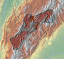
 Topography and outline of the Bogotá savanna | |
| Area | 4,251.6 km2 (1,641.6 sq mi) |
| Geology | |
| Type | Montane savanna |
| Geography | |
| Country | Colombia |
| State | Cundinamarca |
| Region | Andean region |
| Population center | Bogotá |
| Borders on | East: Eastern Hills South: Sumapaz mountains North: Hills of Tausa and Suesca West: Western hills |
| Coordinates | 4°45′0″N 74°10′30″W / 4.75000°N 74.17500°W / 4.75000; -74.17500Coordinates: 4°45′0″N 74°10′30″W / 4.75000°N 74.17500°W / 4.75000; -74.17500 |
| River | Bogotá, Teusacá, Torca, Juan Amarillo, Fucha, Tunjuelo |
| [1] | |

All but the southernmost locality Sumapaz of Bogotá is located on the Bogotá savanna
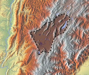
The Bogotá savanna is a montane savanna, located in the southwestern part of the Altiplano Cundiboyacense in the center of Colombia. The Bogotá savanna has an extent of 4,251.6 square kilometres (1,641.6 sq mi) and an average altitude of 2,550 metres (8,370 ft). The savanna is situated in the Eastern Ranges of the Colombian Andes.
The Bogotá savanna is crossed from northeast to southwest by the 375 kilometres (233 mi) long Bogotá River, which at the southwestern edge of the plateau forms the Tequendama Falls (Salto del Tequendama). Other rivers, such as the Subachoque, Bojacá, Fucha, Soacha and Tunjuelo Rivers, tributaries of the Bogotá River, form smaller valleys with very fertile soils dedicated to agriculture and cattle-breeding.
Before the Spanish conquest of the Bogotá savanna, the area was inhabited by the indigenous Muisca, who formed a loose confederation of various caciques, named the Muisca Confederation. The Bogotá savanna, known as Bacatá, was ruled by the zipa. The people specialised in agriculture, the mining of emeralds, trade and especially the extraction of rock salt from rocks in Zipaquirá, Nemocón, Tausa and other areas on the Bogotá savanna. The salt extraction, a task exclusively of the Muisca women, gave the Muisca the name "The Salt People".
In April 1536, a group of around 800 conquistadors left the relative safety of the Caribbean coastal city of Santa Marta to start a strenuous expedition up the Magdalena River, the main fluvial artery of Colombia. Word got around among the Spanish colonisers that deep in the unknown Andes, a rich area with an advanced civilisation must exist. These tales bore the -not so much- legend of El Dorado; the city or man of gold. The Muisca, skilled goldworkers, held a ritual in Lake Guatavita where the new zipa would cover himself in gold dust and jump from a raft into the cold waters of the 3,000 metres (9,800 ft) high lake to the northeast of the Bogotá savanna.
After a journey of almost a year, where the Spanish lost over 80% of their soldiers, the conquistadors following the Suárez River, reached the Bogotá savanna in March 1537. The zipa who ruled the Bogotá savanna at the arrival of the Spanish was Tisquesusa. The Muisca posed little resistance to the Spanish strangers and Tisquesusa was defeated in April 1537 in Funza, in the centre of the savanna. He fled towards the western hills and died of his wounds in Facatativá, on the southwestern edge of the Bogotá savanna. The Spanish conquistador Gonzalo Jiménez de Quesada established the New Kingdom of Granada with capital Santa Fe de Bogotá on August 6, 1538. This started a process of colonisation, evangelisation and submittance of the Muisca to the new rule. Between 65 and 80% of the indigenous people perished due to European diseases as smallpox and typhus. The Spanish introduced new crops, replacing many of the New World crops that the Muisca cultivated.
Over the course of the 16th to early 20th century, the Bogotá savanna was sparsely populated and industrialised. The rise in population during the twentieth century and the expansion of agriculture and urbanisation reduced the biodiversity and natural habitat of the Bogotá savanna severely. Today, the Metropolitan Area of Bogotá on the Bogotá savanna hosts more than ten million people. Bogotá is the biggest city worldwide at altitudes above 2,500 metres (8,200 ft). The many rivers on the savanna are highly contaminated and efforts to solve the environmental problems are conducted in the 21st century.
Contents
1 Etymology
2 Geography
2.1 Climate
2.2 Hydrology
2.2.1 Rivers
2.2.2 Lakes
2.2.2.1 Natural
2.2.2.2 Artificial
2.3 Waterfalls
2.4 Wetlands
3 Biodiversity
4 History
4.1 Muisca Confederation
4.2 Spanish conquest
4.3 Modern history
4.4 Timeline of inhabitation
5 Cities
5.1 List of municipalities
6 Panoramas
7 See also
8 References
8.1 Notes
8.2 Bibliography
8.2.1 Geology
8.2.2 Wetlands
8.2.3 Flora and fauna
8.2.4 History
8.2.4.1 Preceramic
8.2.4.2 Muisca
8.2.4.3 Conquest and colonial period
Etymology
The Bogotá savanna is named after Bogotá, which is derived from Muysccubun Bacatá, which means "(Enclosure) outside of the farm fields".[2]
Geography

Hills of Sesquilé in the northeast of the Bogotá savanna

The climber's paradise Rocas de Suesca form the northeastern boundary of the Bogotá savanna
The Bogotá savanna is the southwestern part of the larger Andean plateau, the Altiplano Cundiboyacense. The savanna is a montane savanna, bordered to the east by the Eastern Hills, the Sumapaz mountains in the south, the hills of Tausa and Suesca in the north and western hills of Cundinamarca in the west. The total surface area is 4,251.6 square kilometres (1,641.6 sq mi).[1]
Climate
The average temperature of the plateau is 14 °C (57 °F), but this can fluctuate between 0 and 24 °C (32 and 75 °F). The dry and rainy seasons alternate frequently during the year. The driest months are December, January, February and March. During the rainy months, the temperature tends to be more stable with variations between 9 and 20 °C (48 and 68 °F). June, July and August are the months that present the largest variations of temperature, and during the morning frost in the higher terrains surrounding the savanna is possible. Sometimes also ground frost is present, which has a negative impact on agriculture. Hail is a relatively common phenomenon on the savanna.[3][4]
Hydrology

The Bogotá River separating Cota, Cundinamarca (top) from Bogotá

The Bogotá River is the main river of the Bogotá savanna
Rivers
Bogotá River - 375 kilometres (14,800,000 in)
- Bojacá River
- Fucha River
- Teusacá River
- Juan Amarillo River
- Tunjuelo River
- Soacha River
- Neusa River
- Río Frío
- Subachoque River
Lakes
Natural
Lake Guatavita - overlooking the northeastern part of the savanna- Lake Herrera
Artificial
Tominé Reservoir - northeast, biggest waterbody on the Bogotá savanna - 690 cubic megametres (2.4×10²² cu ft)
Neusa Reservoir - north - 102 cubic megametres (3.6×10²¹ cu ft)
El Muña Reservoir - south - 42 cubic megametres (1.5×10²¹ cu ft)- Lake Herrera (since 1973)[5]
Waterfalls
Tequendama Falls - southwestern limit
Wetlands
There is a system of wetlands (humedales) that regulate the soil moisture acting like sponges for the rain waters. Fifteen wetlands have a protected status, with various wetlands as unprotected. In 1950, the total surface area of the wetlands amounted to 150,000 hectares (370,000 acres), but due to the urbanisation of the Colombian capital the total area has been reduced to 1,500 hectares (3,700 acres).[6]
| Map |
|---|
 Wetlands within Bogotá |
| Wetland | Location | Altitude (m) | Area (ha) | Notes | Image |
|---|---|---|---|---|---|
Guaymaral y Torca | Usaquén Suba | 2547 | 73 | [7][8] | 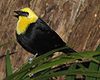 |
La Conejera | Suba | 2544 | 58.9 | [9] | |
Córdoba | Suba | 2548 | 40.51 | [10] |  |
Tibabuyes Juan Amarillo | Suba Engativá | 2539 | 222.58 | [11] |  |
Jaboque | Engativá | 2539 | 148 | [12] | 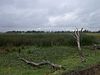 |
Santa María del Lago | Engativá | 2549 | 12 | [13] |  |
El Burro | Kennedy | 2541 | 18.84 | [14] |  |
La Vaca | Kennedy | 2548 | 7.96 | [15] | |
Techo | Techo, Kennedy | 2545 | 11.46 | [16] | |
Capellanía | Fontibón | 2542 | 27.05 | [17] | |
Meandro del Say | Fontibón Mosquera | 2548 | 13.6 | [18] | |
Tibanica | Bosa Soacha | 2542 | 28.8 | [19] | |
El Salitre | Barrios Unidos | 2558 | 6.4 | [20] | |
La Isla | Bosa | 2550 | 7.7 | [21] | |
La Florida | Funza | 2542 | 26 | [22] |  |
Biodiversity
Despite the continuous urbanisation and industrial activities, the Bogotá savanna is a rich biodiverse area with many bird species registered.[23] The diversity of mammals, amphibians and reptiles is much lower.[24] Before the arrival of the European colonisers, the savanna was populated predominantly by white-tailed deer, the main ingredient of the Muisca cuisine. Today, this species of deer, as well as the once common spectacled bear, is restricted to protected areas surrounding the Bogotá savanna. The Thomas van der Hammen Natural Reserve is a protected area in the north of Bogotá.
History
Ab - El Abra
Ti - Tibitó
Te - Tequendama
P - Piedras del Tunjo
Ag - Aguazuque
C - Checua
H - Lake Herrera
The earliest confirmed inhabitation of present-day Colombia was on the Bogotá savanna with sites El Abra, Tequendama and Tibitó, where semi-nomadic hunter-gatherers lived in caves and rock shelters. One of the first evidences of settlement in open area space was Aguazuque, whose oldest dated remains are analysed to be 5000 years old. This prehistorical preceramic period was followed by the Herrera Period, commonly defined from 800 BCE to 800 AD.
Muisca Confederation
At the arrival of the Spanish conquistadors, the region was inhabited by the Muisca who lived in hundreds of small villages scattered across the plateau. These villages were individually ruled by caciques who at the same time paid tribute to the zipa, ruler of Bacatá. The Muisca were known as "The Salt People", thanks to their extraction of rock salt from brines in large pots heated over fires. This process was the exclusive task of the Muisca women.
The economy of the Muisca, meaning "person" or "people" in their indigenous version of Chibcha; Muysccubun, was self-sufficient due to the advanced agriculture on the fertile soils of the frequently flooding Bogotá savanna. More tropical and subtropical agricultural products as avocadoes and cotton were traded with their neighbours, in particular the Guane and Lache in the north and northeast and the Guayupe, Achagua and Tegua in the east.
The Muisca were known as skilled goldworkers, represented in the famous Muisca raft, that symbolises the initiation ritual of the new zipa in Lake Guatavita. This ritual, where the zipa covered himself in gold dust and jumped in the 3,000 metres (9,800 ft) altitude lake, gave rise to the -not so much- legend of El Dorado.
Spanish conquest

Indigenous Muisca fishermen in Funza
Litho by Ramón Torres Méndez

Pottery producing Muisca in Tocancipá
Litho by Ramón Torres Méndez
In April 1536, a group of around 800 conquistadors left the relative safety of the Caribbean coastal city of Santa Marta to start a strenuous expedition up the Magdalena River, the main fluvial artery of Colombia. Word got around among the Spanish colonisers that deep in the unknown Andes, a rich area with an advanced civilisation must exist. These tales bore the -not so much- legend of El Dorado; the city or man of gold. The Muisca, skilled goldworkers, held a ritual in Lake Guatavita where the new zipa would cover himself in gold dust and jump from a raft into the cold waters of the 3,000 metres (9,800 ft) high lake to the northeast of the Bogotá savanna.
After a journey of almost a year, where the Spanish lost over 80% of their soldiers, the conquistadors following the Suárez River, reached the Bogotá savanna in March 1537. The zipa who ruled the Bogotá savanna at the arrival of the Spanish was Tisquesusa. The Muisca posed little resistance to the Spanish strangers and Tisquesusa was defeated in April 1537 in Funza, in the centre of the savanna. He fled towards the western hills and died of his wounds in Facatativá, on the southwestern edge of the Bogotá savanna. The Spanish conquistador Gonzalo Jiménez de Quesada established the New Kingdom of Granada with capital Santa Fe de Bogotá on August 6, 1538. This started a process of colonisation, evangelisation and submittance of the Muisca to the new rule. Between 65 and 80% of the indigenous people perished due to European diseases as smallpox and typhus. The Spanish introduced new crops, replacing many of the New World crops that the Muisca cultivated.
The Spanish colonizers engaged in the construction of Spanish-style towns to replace all the indigenous villages and in the process of assimilation and religious convert of the Muisca. The majority of those villages kept their indigenous names, but some were slightly modified in time, like Suacha which became Soacha, Hyntiba becoming Fontibón and Bacatá becoming Bogotá.
Modern history
Over the course of the 16th to early 20th century, the Bogotá savanna was sparsely populated and industrialised. The rise in population during the twentieth century and the expansion of agriculture and urbanisation reduced the biodiversity and natural habitat of the Bogotá savanna severely. Today, the Metropolitan Area of Bogotá on the Bogotá savanna hosts more than ten million people. Bogotá is the biggest city worldwide at altitudes above 2,500 metres (8,200 ft). The many rivers on the savanna are highly contaminated and efforts to solve the environmental problems are conducted in the 21st century.
Timeline of inhabitation
Timeline of inhabitation of the Bogotá savanna, Colombia | |
 |  Altiplano  Muisca Confederation  |
Cities
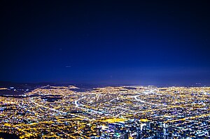
The capital of Colombia, Bogotá, here seen at night from Monserrate, is the main city on the Bogotá savanna. The flatland is clearly visible
The main cities of the Bogotá savanna, in addition to the capital city of Bogotá, are: Mosquera, Soacha, Madrid, Funza, Facatativá, Subachoque, El Rosal, Tabio, Tenjo, Cota, Chía, Cajicá, Zipaquirá, Nemocón, Sopó, Tocancipá, Gachancipá, Sesquilé, Suesca, Chocontá and Guatavita.[25]
List of municipalities
| Municipality Locality | Altitude urban centre (m) | Surface area (km2) | Inhabitants[note 1] | Remarks | Map |
|---|---|---|---|---|---|
Bogotá | 1587 | 7,980,00116 | Named after Bacatá[note 2] Capital of Colombia Biggest city at altitudes above 2,500 metres (8,200 ft) | 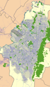 | |
Usaquén | 2650 | 65.31 | 449,62116 |  | |
Chapinero | 2640 | 38.15 | 122,50707 |  | |
Santa Fe | 2640 | 45.17 | 96,24107 |  | |
San Cristóbal | 2640 | 49.09 | 404,35007 |  | |
Usme | 2700 | 119.04 | 314,43107 |  | |
Tunjuelito | 2600 | 9.91 | 182,53207 |  | |
Bosa | 2600 | 23.93 | 637,28315 |  | |
Kennedy | 2700 | 38.59 | 979,91407 |  | |
Fontibón | 2600 | 33.28 | 317,17907 |  | |
Engativá | 2600 | 35.88 | 824,33707 | 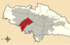 | |
Suba | 2700 | 100.56 | 1,161,50016 |  | |
Barrios Unidos | 2600 | 11.9 | 230,06607 |  | |
Teusaquillo | 2600 | 14.19 | 139,29807 |  | |
Los Mártires | 2600 | 6.51 | 94,94407 |  | |
Antonio Nariño | 2600 | 4.88 | 119,56507 |  | |
Puente Aranda | 2600 | 17.31 | 250,71507 |  | |
La Candelaria | 2640 | 2.06 | 22,11507 |  | |
Rafael Uribe Uribe | 2600 | 13.83 | 378.78007 |  | |
Ciudad Bolívar | 2700 | 130 | 593,93707 |  | |
Soacha | 2565 | 184.45 | 522,44216 | Preceramic site Tequendama Herrera site Muisca ceramics production Petrographs found |  |
Sibaté | 2700 | 125.6 | 38,41215 | Petrographs found El Muña Reservoir |  |
Mosquera | 2516 | 107 | 82,75015 | Lake Herrera Petrographs found |  |
Bojacá | 2598 | 109 | 11,25415 | Lake Herrera Petrographs found |  |
Chía | 2564 | 80 | 129,65216 | Moon Temple Herrera site Petrographs found |  |
Cota | 2566 | 55 | 24,91615 | Petrographs found Muisca community |  |
Cajicá | 2558 | 50.4 | 56,87515 | Located in the funnel of the northern savanna |  |
Facatativá | 2586 | 158 | 134,52215 | Piedras del Tunjo |  |
Funza | 2548 | 70 | 75,35015 | Muisca market town |  |
Madrid | 2554 | 120.5 | 77,62715 | Lake Herrera Petrographs found |  |
El Rosal | 2685 | 86.48 | 17,25415 | 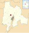 | |
Zipacón | 2550 | 70 | 557015 | Agriculture Place of meditation for the zipa Petrographs found |  |
Subachoque | 2663 | 211.53 | 16,11715 | Petrographs found |  |
Tabio | 2569 | 74.5 | 27,03315 | Hot springs used by the Muisca | 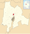 |
Tenjo | 2587 | 108 | 18,38715 | Petrographs found | 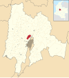 |
Zipaquirá | 2650 | 197 | 124,37615 | El Abra Muisca salt mines Important market town Petrographs and petroglyphs found |  |
Nemocón | 2585 | 98.1 | 13,48815 | Muisca salt mines Preceramic site Checua Petrographs found |  |
Cogua | 2600 | 113 | 22,36115 | Muisca ceramics production Petrographs found Neusa Reservoir | 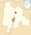 |
Tocancipá | 2605 | 73.51 | 31,97515 | Preceramic site Tibitó Muisca ceramics production Important market town Petrographs found |  |
Gachancipá | 2568 | 44 | 14,44215 | Muisca mummy found Muisca ceramics production | 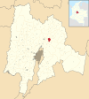 |
Guasca | 2710 | 346 | 14,75915 | Siecha Lakes Muisca ceramics production Petrographs found | 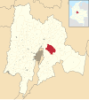 |
Guatavita | 2680 | 247.3 | 689815 | Muisca ceramics production Main goldworking town Petrographs found Tominé Reservoir |  |
Sopó | 2650 | 111.5 | 26,76915 | Herrera site | 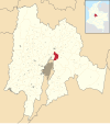 |
Sesquilé | 2595 | 141 | 13,93615 | Lake Guatavita Minor Muisca salt mines | 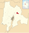 |
Suesca | 2584 | 177 | 17,31815 | 150 Muisca mummies found Lake Suesca Muisca ceramics production Important market town Petrographs found |  |
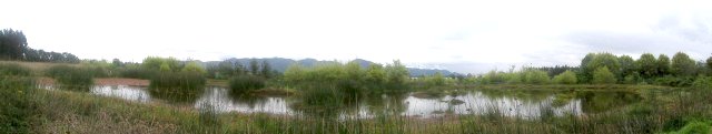
Panoramas
| Panoramas |
|---|


See also
Eastern Ranges
- Eastern Hills, Bogotá
- Ocetá Páramo
- Altiplano Cundiboyacense
- neighbouring Tenza Valley, Sumapaz Páramo
- Bogotá Savannah Railway
- Train for the vicinities of the city of Bogotá
- Thomas van der Hammen
References
^ ab Pérez Preciado, 2000, p.2
^ (in Spanish) Etymology Bacatá - Banco de la República
^ "Climate: Bogotá - Climate graph, Temperature graph, Climate table". Climate-Data.org. Retrieved 2016-09-29..mw-parser-output cite.citation{font-style:inherit}.mw-parser-output q{quotes:"""""""'""'"}.mw-parser-output code.cs1-code{color:inherit;background:inherit;border:inherit;padding:inherit}.mw-parser-output .cs1-lock-free a{background:url("//upload.wikimedia.org/wikipedia/commons/thumb/6/65/Lock-green.svg/9px-Lock-green.svg.png")no-repeat;background-position:right .1em center}.mw-parser-output .cs1-lock-limited a,.mw-parser-output .cs1-lock-registration a{background:url("//upload.wikimedia.org/wikipedia/commons/thumb/d/d6/Lock-gray-alt-2.svg/9px-Lock-gray-alt-2.svg.png")no-repeat;background-position:right .1em center}.mw-parser-output .cs1-lock-subscription a{background:url("//upload.wikimedia.org/wikipedia/commons/thumb/a/aa/Lock-red-alt-2.svg/9px-Lock-red-alt-2.svg.png")no-repeat;background-position:right .1em center}.mw-parser-output .cs1-subscription,.mw-parser-output .cs1-registration{color:#555}.mw-parser-output .cs1-subscription span,.mw-parser-output .cs1-registration span{border-bottom:1px dotted;cursor:help}.mw-parser-output .cs1-hidden-error{display:none;font-size:100%}.mw-parser-output .cs1-visible-error{font-size:100%}.mw-parser-output .cs1-subscription,.mw-parser-output .cs1-registration,.mw-parser-output .cs1-format{font-size:95%}.mw-parser-output .cs1-kern-left,.mw-parser-output .cs1-kern-wl-left{padding-left:0.2em}.mw-parser-output .cs1-kern-right,.mw-parser-output .cs1-kern-wl-right{padding-right:0.2em}
^ "Weatherbase: Historical Weather for Bogota, Colombia". Weatherbase. Retrieved 2016-09-29.
^ (in Spanish) Lake Herrera largest water reserve of the Bogotá savanna
^ Moreno et al., s.a., p.2
^ Humedal Guaymaral
^ Humedal Torca
^ Humedal La Conejera
^ Humedal Córdoba
^ Humedal Tibabuyes
^ Humedal Jaboque
^ Humedal Santa María del Lago
^ Humedal El Burro
^ Humedal La Vaca
^ Humedal Techo
^ Humedal Capellanía
^ Humedal Meandro del Say
^ Humedal Tibanica
^ Humedal El Salitre
^ Humedal La Isla
^ Humedal La Florida
^ Calvachi Zambrano, 2002, p.95
^ Calvachi Zambrano, 2002, p.97
^ Cities on the Bogotá savanna Archived November 13, 2013, at the Wayback Machine.
Notes
^ 07; 2007, 15; 2015, 16; 2016
^ Bacatá refers to the southern part of the Bogotá savanna, ruled by the zipa based in Funza, but with various frequently visited other settlements, visibles in the names Nemocón (Nemequene), Zipacón, Zipaquirá, Tocancipá, Gachancipá
Bibliography
Geology
Struth, Lucía; Julien Babault, and Antonio Teixell. 2015. Drainage reorganization during mountain building in the river system of the Eastern Cordillera of the Colombian Andes. Geomorphology 250. 1-41. Accessed 2018-05-12.
Dueñas, Hernando. 1980. Palinología de los sedimentos pliocénicos y cuaternarios de la Sabana de Bogotá. Boletín Instituto de Geociencias 31. 168-180.
Montoya Arenas, Diana María, and Germán Alfonso Reyes Torres. 2005. Geología de la Sabana de Bogotá, 1–104. INGEOMINAS.
De Porta, J. 1965. La posición estratigráfica de la fauna de Mamíferos del Pleistocene de la Sabana de Bogotá, 37-54. Universidad Nacional de Colombia.
De Porta, J. 1960. Los equidos fósiles de la Sabana de Bogotá, 51-78. Universidad Nacional de Colombia.
Huertas, Gustavo. 1960. De la flora fósil de la Sabana. Boletín Geológico, Universidad Industrial de Santander, Bucaramanga 5. 53-57.
Wetlands
Andrade L., Martha Esperanza, and Henry Benitez Castañeda. s.a. Los Humedales de la Sabana de Bogotá: Área Importante para la Conservación de las Aves de Colombia y el Mundo, 1-38. AICAS. Accessed 2017-03-04.
Moreno, Vanesa; Juan Francisco García, and Juan Carlos Villalba. s.a. Descripción general de los humedales de Bogotá D.C., 1-28. Sociedad Geográfica de Colombia. Accessed 2017-03-04.
Sandoval Rincón, Diana Marcela. 2013. Protected Areas in the City, Urban Wetlands of Bogotá. Cuadernos de Vivienda y Urbanismo 6. 80-103. Accessed 2017-03-04.
Flora and fauna
Calvachi Zambrano, Byron. 2002. La biodiversidad bogotana. Revista La Tadeo 67. 89-98. Accessed 2017-03-04.
Pérez Preciado, Alfonso. 2000. La estructura ecológica principal de la Sabana de Bogotá, 1-37. Sociedad Geográfica de Colombia. Accessed 2017-03-04.
History
Preceramic
Cardale de Schrimpff, Marianne. 1985. En busca de los primeros agricultores del Altiplano Cundiboyacense - Searching for the first farmers of the Altiplano Cundiboyacense, 99–125. Banco de la República. Accessed 2016-07-08.
Correal Urrego, Gonzalo. 1990. Aguazuque: Evidence of hunter-gatherers and growers on the high plains of the Eastern Ranges, 1-316. Banco de la República: Fundación de Investigaciones Arqueológicas Nacionales. Accessed 2016-07-08.
Muisca
Argüello García, Pedro María. 2015. Subsistence economy and chiefdom emergence in the Muisca area. A study of the Valle de Tena (PhD), 1–193. University of Pittsburgh. Accessed 2016-07-08.
Broadbent, Sylvia M.. 1965. Investigaciones arqueológicas en el Territorio Chibcha - Archaeological investigations in the Chibcha Territory, 1–38. Accessed 2016-07-08.
Cooper, Jago. 2013. The Lost Kingdoms of South America - Episode 3 - Lands of Gold. Accessed 2016-07-14.
Daza, Blanca Ysabel. 2013. Historia del proceso de mestizaje alimentario entre Colombia y España - History of the integration process of foods between Colombia and Spain (PhD), 1-494. Universitat de Barcelona.
Francis, John Michael. 1993. "Muchas hipas, no minas" The Muiscas, a merchant society: Spanish misconceptions and demographic change (M.A.), 1-118. University of Alberta.
Gamboa Mendoza, Jorge. 2016. Los muiscas, grupos indígenas del Nuevo Reino de Granada. Una nueva propuesta sobre su organizacíon socio-política y su evolucíon en el siglo XVI - The Muisca, indigenous groups of the New Kingdom of Granada. A new proposal on their social-political organization and their evolution in the 16th century. Museo del Oro. Accessed 2016-07-08.
Kruschek, Michael H.. 2003. The evolution of the Bogotá chiefdom: A household view (PhD), 1-271. University of Pittsburgh. Accessed 2016-07-08.
Conquest and colonial period
Friede, Juan. 1960. Descubrimiento del Nuevo Reino de Granada y Fundación de Bogotá (1536-1539), 1-342. Banco de la República. Accessed 2016-12-26.
Biodiversity of Colombia | |||||||
|---|---|---|---|---|---|---|---|
| General biota |
|  | |||||
| Regional biota |
| ||||||
| Ecoregions |
| ||||||
| Nature reserves |
| ||||||
| Organisations |
| ||||||
| |||||||
 | Administrative subdivision in 20 localities |
|  |
|---|---|---|---|
| Metropolitan Area |
| ||
| Geography |
| ||
| |||
| |||
Sedimentary basins of Colombia | ||||||||
|---|---|---|---|---|---|---|---|---|
| Onshore |
|  | ||||||
| Offshore |
| |||||||
| Source | • Barrero, Dario; Andrés Pardo; Carlos A. Vargas, and Juan F. Martínez. 2007. Colombian Sedimentary Basins: Nomenclature, Boundaries and Petroleum Geology, a New Proposal, 1–92. ANH. | |||||||
Muisca | |||||||||||||||||||||||||||
|---|---|---|---|---|---|---|---|---|---|---|---|---|---|---|---|---|---|---|---|---|---|---|---|---|---|---|---|
| |||||||||||||||||||||||||||
| |||||||||||||||||||||||||||
| |||||||||||||||||||||||||||
| |||||||||||||||||||||||||||
| |||||||||||||||||||||||||||
| |||||||||||||||||||||||||||
| |||||||||||||||||||||||||||


